
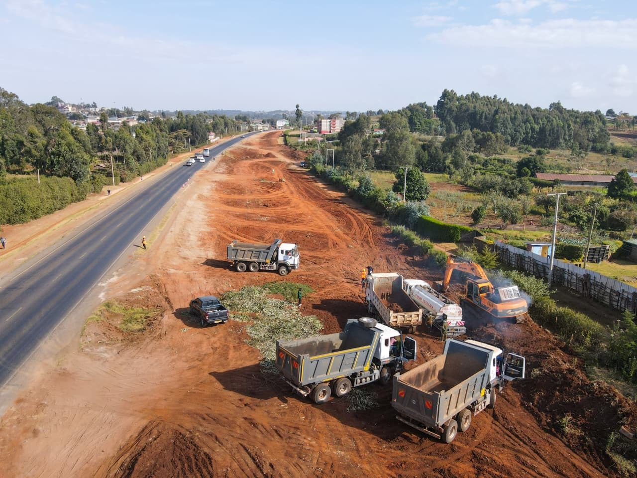
The Kenya Kwanza Administration has placed road infrastructure at the heart of the Bottom-Up Economic Transformation Agenda (BETA), recognizing connectivity as a critical enabler of production, trade, investment, job creation and access to economic opportunity. The national road development program is designed to connect farms to markets, businesses to consumers, communities to essential services and productive regions to domestic and regional trade corridors.
Under BETA, investment in roads is anchored in the economic activity that infrastructure enables. Every kilometer opened, upgraded or rehabilitated has the potential to lower the cost of moving goods and people, expand market access, strengthen agricultural value chains, support industrial development and improve the competitiveness of enterprises across our country.
THE FIVE PILLARS OF THE BETA INFRASTRUCTURE MANDATE
- AGRICULTURAL VALUE-CHAIN CONNECTIVITY
The Kenya Kwanza Administration has been prioritizing roads serving agricultural production zones to improve connectivity between farms, aggregation centers, markets and processing facilities. Better rural connectivity reduces transport costs and post-harvest losses while strengthening the commercial viability of dairy, tea, coffee, horticulture and other agricultural value chains. - MSME AND MARKET ACCESS
Road infrastructure is being aligned with markets, trading centers and major transport corridors to expand commercial access for MSMEs. Improved connectivity increases customer reach, strengthens movement of merchandise and integrates local enterprises into larger county, national and regional markets. - AFFORDABLE HOUSING AND URBAN DEVELOPMENT
Transport infrastructure forms part of the wider planning around Affordable Housing Program sites and growing urban settlements. Access roads, drainage and supporting infrastructure are essential to functional neighborhoods, improved mobility and the development of economically productive urban centers. - HEALTHCARE AND ESSENTIAL SERVICES CONNECTIVITY
Road development supports reliable access to hospitals, health facilities, schools and other essential public services. Improved connectivity strengthens emergency response, reduces travel times and expands the geographical reach of critical government services. - DIGITAL INFRASTRUCTURE INTEGRATION
The Kenya Kwanza Administration has been advancing integrated infrastructure planning that aligns transport development with the expansion of the country’s digital backbone. Coordinating road corridors with fiber-optic infrastructure supports the expansion of broadband connectivity, digital services and the digital economy.
THE BETA INFRASTRUCTURE MATRIX
AGRICULTURE → Farm-to-Market Connectivity
MSMEs → Markets and Commercial Corridors
HOUSING → Access Roads and Urban Infrastructure
HEALTHCARE → Connectivity to Essential Services
DIGITAL ECONOMY → Fiber and Digital Infrastructure
FINANCING, DELIVERY AND PROJECT IMPLEMENTATION
The Kenya Kwanza Administration has been addressing the financing constraints that have affected road construction and contractor performance while mobilizing resources to accelerate completion of priority infrastructure. The Government’s approach combines budgetary allocations, the Road Maintenance Levy Fund, alternative financing mechanisms and private capital where appropriate to restore momentum across the national road portfolio.
The implementation framework also recognizes that infrastructure delivery requires effective coordination between national agencies, county governments, contractors and communities. National Government Administrative Officers provide grassroots coordination where required, including supporting community engagement, security coordination and resolution of local administrative issues that could affect implementation.
The objective is to translate infrastructure investment into measurable economic outcomes: lower logistics costs, stronger agricultural value chains, expanded market access, increased private investment, more competitive enterprises and greater economic opportunity across all 47 counties.
INSTITUTIONAL FRAMEWORK AND STATUTORY DELIVERY MECHANISMS
The delivery of large-scale road infrastructure under the Bottom-Up Economic Transformation Agenda (BETA) is anchored in a structured institutional, statutory and financing framework that translates national development priorities into implementable infrastructure projects. The framework brings together policy direction, specialized road agencies, road-sector financing institutions, development partners, private investors, contractors and Public Private Partnership institutions within a coordinated project delivery system.
At the policy level, the Ministry of Roads and Transport provides strategic direction for the road sector and guides the alignment of infrastructure investment with national development priorities. At the implementation level, specialized road authorities undertake the development, rehabilitation, management and maintenance of roads within their statutory mandates. The Kenya Roads Board supports the financing and oversight of road maintenance, while the Public Private Partnerships framework creates a structured pathway for mobilizing private capital, technical expertise, innovation and long-term asset-management capability into qualifying infrastructure projects.
Under BETA, this institutional architecture supports an infrastructure program focused on economic productivity. Road investment is linked to agricultural production, industrial development, urban growth, housing, trade, logistics and access to essential services. The institutional framework provides the mechanisms through which these priorities move from policy decisions into project identification, feasibility studies, engineering design, financing, procurement, construction and long-term maintenance.
The national road program can draw on public financing, development finance, alternative financing mechanisms and PPP structures. The delivery model selected for each project is informed by its strategic purpose, capital requirements, technical complexity, affordability, financial characteristics, risk profile and long-term operational requirements.
INSTITUTIONAL ROAD DELIVERY FRAMEWORK
| INSTITUTION | PRIMARY MANDATE | ROLE IN INFRASTRUCTURE DELIVERY |
| Ministry of Roads and Transport | Sector policy and strategic direction | Provides national road-sector policy, planning, strategic coordination and oversight. |
| Kenya National Highways Authority (KeNHA) | National trunk roads | Develops, rehabilitates, manages and maintains strategic national highways and economic corridors. |
| Kenya Urban Roads Authority (KURA) | Urban roads | Develops, rehabilitates, manages and maintains road infrastructure within its urban mandate. |
| Kenya Rural Roads Authority (KeRRA) | Rural roads | Develops, rehabilitates, manages and maintains road infrastructure within its rural mandate. |
| Kenya Roads Board (KRB) | Road maintenance financing and oversight | Supports the financing, allocation and oversight of resources for maintenance of the road network. |
| PPP Directorate | PPP project development and transaction support | Supports contracting authorities in project development, appraisal, structuring, procurement and implementation of PPP transactions. |
THE ROAD IMPLEMENTING AUTHORITIES
KENYA NATIONAL HIGHWAYS AUTHORITY (KeNHA)
The Kenya National Highways Authority is responsible for the development, rehabilitation, management and maintenance of the national trunk road network. Its mandate covers strategic highways and corridors that connect major economic centers, ports, border points, industrial areas, agricultural production regions and regional markets.
These corridors form an essential component of Kenya’s economic infrastructure. They carry agricultural produce from production regions to processing and consumption centers, connect manufacturers to domestic and export markets, facilitate movement to and from ports and border crossings, support passenger mobility and provide critical connections to the wider East African transport network.
Under BETA, investment in the national trunk road network supports the Government’s objective of reducing logistics constraints and improving connectivity between areas of production and areas of consumption. Efficient trunk corridors strengthen supply chains, support industrial competitiveness, improve access to regional markets and provide the transport backbone required for investment across multiple sectors of the economy.
The development of strategic highways also supports Kenya’s role as a regional transport and logistics hub. Road corridors connecting the Port of Mombasa and other logistics infrastructure to inland markets facilitate trade serving Kenya and the wider Eastern and Central African region.
KENYA URBAN ROADS AUTHORITY (KURA)
The Kenya Urban Roads Authority is responsible for the development, rehabilitation, management and maintenance of road infrastructure within its urban mandate. Its work addresses the mobility and infrastructure requirements generated by the expansion of cities, municipalities and commercial centers.
Urban road development encompasses road construction and rehabilitation, junction improvements, drainage infrastructure, pedestrian facilities, non-motorized transport infrastructure and associated interventions required to improve movement within densely populated economic centers.
Under BETA, urban transport infrastructure supports the growth of commercial centers, markets, industrial areas, Affordable Housing developments and emerging urban settlements. Reliable road connectivity enables workers to reach employment centers, facilitates movement of goods between businesses and consumers and supports access to schools, hospitals and public services.
Urban road planning also interacts directly with land use and settlement patterns. New housing developments, commercial districts and industrial areas generate additional transport demand, requiring road capacity, drainage, pedestrian infrastructure and connections to existing transport networks to be incorporated into wider urban development planning.
KENYA RURAL ROADS AUTHORITY (KeRRA)
The Kenya Rural Roads Authority is responsible for the development, rehabilitation, management and maintenance of roads within its rural mandate. Its role is closely connected to the agricultural and grassroots economic objectives of BETA because rural roads provide the first physical connection between production areas and the wider economy.
A functioning rural road network enables farmers to move produce from farms to aggregation centers, cooperatives, processors and markets. It facilitates movement of agricultural inputs into production areas and supports access to veterinary services, extension services, financial institutions and other services required by the rural economy.
Road conditions directly influence transport costs, travel times, post-harvest handling and the ability of buyers and processors to access production areas. Investment in rural connectivity therefore supports agricultural commercialization, food distribution and the integration of smallholder farmers into national value chains.
Rural roads also connect communities to schools, healthcare facilities, administrative centers and employment opportunities, giving road investment an economic and social function within the BETA framework.
PUBLIC PRIVATE PARTNERSHIPS IN ROAD INFRASTRUCTURE DELIVERY
Public Private Partnerships form an important component of the Kenya Kwanza Administration’s infrastructure delivery architecture. The PPP framework provides a structured mechanism for mobilizing private capital, technical expertise, innovation and long-term operational capability into qualifying infrastructure projects.
The framework is anchored in the Public Private Partnerships Act, 2021. Under the statutory structure, a Government entity responsible for an infrastructure project can serve as the contracting authority, while the PPP Directorate provides technical and transaction support throughout project development and implementation.
In the roads sector, this allows agencies such as KeNHA and other eligible contracting authorities to develop projects capable of being structured for private participation. The PPP Directorate supports the assessment of project viability, preparation of feasibility studies, financial and commercial analysis, transaction structuring, procurement processes and implementation of the resulting project agreement.
PPP project preparation incorporates technical engineering requirements alongside financial, legal and commercial considerations. Traffic projections, construction costs, land requirements, environmental and social obligations, operating expenditure, maintenance requirements, financing costs, revenue structures and project risks are assessed as part of the development of a bankable transaction.
A central component of PPP structuring is risk allocation. Construction risk, financing risk, operating risk, maintenance risk, demand or traffic risk, land-related risks and other project-specific exposures are identified, assessed and allocated through the project agreement. The objective is to place defined responsibilities with the party capable of managing them effectively while establishing clear contractual performance requirements.
The PPP structure can also incorporate the entire lifecycle of the road asset. Depending on the transaction, the private partner may undertake design, financing, construction, operation and maintenance over an agreed period. Performance requirements established in the project agreement govern infrastructure quality, availability, maintenance and service delivery throughout the contractual term.
PPP PROJECT DELIVERY FRAMEWORK
| STAGE | ACTIVITY AND PURPOSE |
| 1. Project Identification | The contracting authority identifies a priority infrastructure requirement and establishes its alignment with sector and national development objectives. |
| 2. Preliminary Assessment | Initial technical, economic and financial analysis establishes the preliminary scope, costs, demand and potential delivery structure. |
| 3. Feasibility and PPP Assessment | Detailed technical, financial, commercial, legal, environmental and social studies establish project viability, affordability, value for money and PPP suitability. |
| 4. Project Development | Engineering, financial and transaction preparation develops the project to a level capable of supporting procurement and investment decisions. |
| 5. Transaction Structuring | The project structure establishes financing arrangements, payment mechanisms, performance standards, contractual responsibilities and risk allocation. |
| 6. Competitive Procurement | Qualified private parties compete for the right to implement the project under the applicable statutory PPP process. |
| 7. Project Agreement | Government and the selected private partner establish contractual obligations, performance requirements, payment arrangements, risk allocation and handover conditions. |
| 8. Financial Close | Equity investors and lenders finalize the financing arrangements required for project implementation. |
| 9. Construction | The private partner mobilizes financing, engineering capability, contractors, equipment and materials to deliver the infrastructure. |
| 10. Operations and Maintenance | Applicable operating and maintenance obligations are undertaken according to contractual performance standards. |
| 11. Contractual Handover | The infrastructure asset is transferred according to the conditions and asset standards established in the project agreement. |
FINANCIAL MOBILIZATION ARCHITECTURE
Delivering Kenya’s road infrastructure program requires substantial and sustained capital. The Kenya Kwanza Administration has been pursuing a diversified financing architecture that brings together Government resources, road-sector revenues, development finance, alternative financing mechanisms and private investment.
Public financing provides resources for road construction, rehabilitation and maintenance through the national budgeting framework and dedicated road-sector funding mechanisms. The Road Maintenance Levy Fund supports maintenance of the road network within the statutory framework overseen by the Kenya Roads Board.
Maintenance financing is essential to infrastructure sustainability because road assets require periodic interventions throughout their operational life. Pavement rehabilitation, drainage maintenance, road markings, safety infrastructure and other preservation works protect previous capital investment and sustain the economic functionality of the network.
Development finance provides another major source of infrastructure capital and project-preparation capability. Institutions including the World Bank Group, African Development Bank Group (AfDB), Japan International Cooperation Agency (JICA) and other bilateral and multilateral partners have supported transport infrastructure through financing, technical assistance, institutional support and project preparation.
Development financing can support feasibility studies, detailed engineering, environmental and social safeguards, construction and institutional strengthening. These interventions contribute to the development of technically prepared and financially structured infrastructure projects capable of progressing into implementation.
Private capital mobilized through PPPs adds long-term financing capacity to the infrastructure program. PPP transactions can incorporate equity from project sponsors, commercial debt from lenders, institutional capital and other financing instruments appropriate to the structure of the individual project.
The integration of these financing channels expands the Government’s capacity to develop a wider infrastructure pipeline and align individual projects with financing structures suited to their technical, economic and commercial characteristics.
ROAD INFRASTRUCTURE FINANCING MODEL
| FINANCING CHANNEL | PRINCIPAL SOURCES | ROLE IN ROAD INFRASTRUCTURE |
| Public Finance | National Budget, RMLF and other Government resources | Supports construction, rehabilitation, maintenance and associated road infrastructure requirements. |
| Development Finance | World Bank Group, AfDB, JICA and bilateral and multilateral partners | Supports capital investment, project preparation, technical assistance and institutional strengthening. |
| Private Capital / PPPs | Private equity, commercial lenders, institutional investors and infrastructure capital | Provides long-term capital and private-sector capability for qualifying PPP transactions. |
| Blended and Alternative Financing | Structured combinations of available financing sources | Supports projects requiring tailored financing arrangements aligned with affordability, risk and project requirements. |
THE ROAD INFRASTRUCTURE DEVELOPMENT LIFECYCLE
The physical construction of a road represents one stage within a much wider infrastructure development process. Successful road delivery begins with project identification and progresses through feasibility, environmental and social assessment, engineering design, financing, procurement, construction, commissioning, operations and long-term asset management.
Project identification establishes the transport problem that the proposed investment is intended to address. This may arise from congestion, inadequate connectivity, increasing freight demand, agricultural production, urban expansion, industrial development, regional trade requirements or the need to improve access to particular communities and economic centers.
Feasibility studies then establish whether the proposed investment is technically, economically and financially viable. Traffic studies assess current and projected demand, while engineering investigations examine terrain, soils, hydrology, existing infrastructure and the physical requirements of the proposed road.
Environmental and social assessment forms part of project preparation. Potential impacts on communities, ecosystems, water resources, land use and livelihoods are identified, and appropriate mitigation measures are incorporated into project planning. Land acquisition and resettlement requirements are also assessed where applicable.
Detailed engineering design translates the project concept into technical specifications capable of supporting procurement and construction. Engineers establish horizontal and vertical road alignment, pavement composition, bridges and structures, drainage systems, junctions, road safety features, non-motorized transport requirements and associated infrastructure.
Financial and delivery-model assessment establishes how the project will be funded and implemented. The analysis considers capital requirements, affordability, financing sources, procurement strategy, long-term maintenance requirements, commercial characteristics and project risks.
For PPP projects, this stage includes detailed commercial and financial modelling, affordability analysis, value-for-money assessment, bankability analysis and allocation of risks between the contracting authority and the prospective private partner.
Procurement converts the prepared project into an executable contract. Technical specifications, performance standards, contractual obligations and financing requirements are incorporated into the procurement process, enabling the responsible authority to select a contractor or private partner capable of delivering the required infrastructure.
Construction involves mobilization of equipment, personnel, materials and financing. Civil works can include site clearance, earthworks, formation preparation, drainage, sub-base and base-course construction, pavement surfacing, bridges, culverts, interchanges, junctions, road furniture and safety installations.
Testing and commissioning verify that the completed infrastructure meets the required engineering specifications, safety standards and contractual performance requirements before full operational use.
Operations and maintenance preserve the functionality and economic value of the asset. Maintenance includes routine works, periodic interventions, pavement rehabilitation, drainage management, safety improvements and other activities required to sustain road performance throughout its design life.
Under applicable PPP structures, operations and maintenance obligations may form part of the private partner’s contractual responsibilities over the concession period. Performance is measured against standards established in the project agreement, with the infrastructure ultimately proceeding to contractual handover according to the agreed terms.
ROAD PROJECT DEVELOPMENT LIFECYCLE
| STAGE | CORE ACTIVITY | EXPECTED OUTPUT |
| 1. Project Identification | Establish the transport need, economic rationale and strategic priority. | Defined project concept and development objective. |
| 2. Feasibility and Traffic Analysis | Assess demand, engineering feasibility, economic viability and preliminary costs. | Established project viability and preliminary scope. |
| 3. Environmental and Social Assessment | Assess environmental impacts, land requirements, resettlement and community considerations. | Safeguards framework, mitigation requirements and applicable approvals. |
| 4. Detailed Engineering Design | Establish road geometry, pavement, drainage, structures, safety systems and technical specifications. | Construction-ready engineering design and cost estimates. |
| 5. Financing and Delivery Assessment | Assess capital requirements, financing sources, affordability, procurement structure and project risks. | Defined financing and delivery structure. |
| 6. Transaction / Contract Structuring | Establish contractual responsibilities, performance standards, payment arrangements and risk allocation. | Procurement-ready contractual and transaction framework. |
| 7. Procurement and Contract Award | Select the contractor or private partner through the applicable procurement process. | Executed construction contract or PPP project agreement. |
| 8. Financing / Financial Close | Confirm and mobilize the financing required for implementation. | Funding available for project execution. |
| 9. Construction | Execute civil works according to approved engineering designs and contractual requirements. | Completed physical infrastructure. |
| 10. Testing and Commissioning | Verify engineering, safety and contractual performance. | Road asset approved for operation. |
| 11. Operations and Maintenance | Preserve asset condition and deliver required operational performance. | Sustained road functionality and service standards. |
| 12. Long-Term Asset Management / Handover | Manage infrastructure over its lifecycle and complete applicable contractual transfer. | Preserved infrastructure asset under the appropriate long-term management framework. |
The institutional, statutory and financing framework provides the Kenya Kwanza Administration with an integrated system for delivering road infrastructure under BETA. Public financing supports Government-funded investment and maintenance, development finance mobilizes capital and technical support for strategic infrastructure, and Public Private Partnerships provide a framework for bringing private capital and expertise into qualifying projects. These mechanisms support the progression of road infrastructure from national development priority to project preparation, financing, construction, operations and long-term asset management.
NORTHERN FRONTIER CORRIDORS AND THE HORN OF AFRICA GATEWAY DEVELOPMENT PROJECT (HoAGDP)
The transformation of Kenya’s northern frontier is being advanced through one of the country’s most consequential integrated infrastructure investments, the Horn of Africa Gateway Development Project (HoAGDP). The project is developing the approximately 740 km Isiolo–Wajir–Mandera corridor as a strategic transport, trade and economic artery connecting northern Kenya to the national economy and extending Kenya’s commercial reach toward Ethiopia, Somalia and the wider Horn of Africa.
The corridor has significance far beyond the construction of a bitumen road. Isiolo, Wajir and Mandera sit across an expansive economic geography characterized by livestock production, pastoral mobility, cross-border commerce, emerging urban centers and long distances between markets and essential services. Infrastructure limitations across this geography have historically constrained the movement of goods, raised logistics costs, limited market reach and reduced the ability of communities and enterprises to convert productive activity into income.
HoAGDP addresses these structural constraints through an integrated corridor-development model. Approximately 740 km of road infrastructure, 740 km of fiber-optic connectivity, 14 livestock holding grounds, 6 regional veterinary diagnostic laboratories and 22 market enclosures with solar-powered milk cooling facilities are being developed within the same economic corridor.
This integration is central to the Bottom-Up Economic Transformation Agenda (BETA). The road provides mobility. Fiber provides digital connectivity. Livestock infrastructure strengthens production and animal health. Markets provide points of aggregation and exchange. Cold-chain facilities support preservation and commercialization. Together, these investments create the physical and productive infrastructure required to connect northern Kenya’s communities, producers and enterprises to larger markets.
A 740 KM STRATEGIC ECONOMIC CORRIDOR
HoAGDP encompasses the upgrading of approximately 740 km along the Isiolo–Wajir–Mandera axis. The corridor creates a continuous transport spine running from Isiolo through the northeastern counties toward Mandera and Kenya’s frontier with the Horn of Africa.
Isiolo provides the southern anchor and connects the project area to the wider national transport network. Wajir functions as a major administrative, commercial and livestock center serving northeastern Kenya. Mandera occupies a strategic frontier position adjoining Ethiopia and Somalia, giving the northern end of the corridor direct relevance to cross-border movement and regional commerce.
The development of this axis therefore connects three layers of economic activity. It strengthens movement within northern counties, links those counties to the rest of Kenya and provides infrastructure supporting Kenya’s commercial interaction with neighboring markets.
For pastoral communities, the corridor provides access between livestock production areas, veterinary services, aggregation points and markets. For traders and MSMEs, it expands the geographic reach of customers and suppliers. For transport and logistics operators, it establishes a reliable all-weather corridor. For Government, it strengthens physical and digital access to settlements and administrative centers across an extensive frontier region.
USD 750 MILLION INFRASTRUCTURE MOBILIZATION
The project is supported by a financing portfolio of approximately USD 750 million, equivalent to more than KES 100 billion, structured primarily through the International Development Association (IDA) of the World Bank Group alongside financing involving the African Development Bank (AfDB) and the Government of Kenya.
The scale of the financing reflects the integrated nature of the investment. Resources extend across road construction, drainage and climate resilience, telecommunications infrastructure and socioeconomic facilities supporting communities and productive activities along the corridor.
This financing architecture enables large-scale civil works to proceed across multiple sections while supporting infrastructure that converts improved connectivity into economic utility. The investment is therefore deployed across the corridor itself and the economic systems operating around it.
HoAGDP INVESTMENT AND DELIVERY FOOTPRINT
| INDICATOR | PROJECT SCALE | STRATEGIC FUNCTION |
| Total Corridor | 740 km | Connects Isiolo, Wajir, Mandera and the Horn of Africa frontier |
| Financing Portfolio | USD 750 million | Funds integrated corridor development |
| Approximate KES Value | KES 100+ billion | Represents major capital deployment into northern Kenya |
| Fiber-Optic Infrastructure | 740 km | Establishes a parallel digital corridor |
| Livestock Holding Grounds | 14 | Supports livestock aggregation, handling and trade |
| Veterinary Diagnostic Laboratories | 6 | Strengthens animal health and livestock value protection |
| Market Enclosures | 22 | Creates organized nodes for local commerce |
| Package 1 Progress | 45% | Most advanced section of current civil works |
| Package 2 Progress | 28% | Active corridor construction |
| Package 3 Progress | 15% | Early-stage civil works |
| Package 4 Progress | 8% | Mobilization and initial engineering works |
CONCURRENT CONSTRUCTION ACROSS THE NORTHERN FRONTIER
The 740 km corridor has been divided into construction packages to enable multiple sections to advance concurrently. This approach distributes engineering activity across the corridor and allows contractors to respond to different terrain, drainage, material and logistical conditions within each geographical section.
PACKAGE 1: ISIOLO–KULAMAWE–MODOGASHE
Package 1 covers approximately 218 km and has reached 45% completion, making it the most advanced of the four construction packages.
Civil works encompass structural earthworks, formation preparation, stabilization of sub-base materials and installation of high-capacity box culverts. Drainage infrastructure is particularly significant along sections exposed to seasonal flash flooding, where uncontrolled water movement can damage road formations and interrupt connectivity.
The Isiolo–Modogashe section establishes the southern entry into the northern corridor and provides the connection through which traffic from Wajir, Mandera and surrounding production areas can access the wider national transport network.
PACKAGE 2: MODOGASHE–SAMATAR–WAJIR
Package 2 extends approximately 157 km and has reached 28% completion.
Engineering teams are undertaking heavy grading, earthworks and establishment of primary base-course layers. These works progressively create the structural pavement platform required to support the final road surface and anticipated traffic loads.
The section strengthens the connection into Wajir, providing a critical link for passenger movement, livestock trade, commercial transport and supply chains serving communities across northeastern Kenya.
PACKAGE 3: WAJIR–TARBAJ–KUTULO
Package 3 covers approximately 119 km and has recorded 15% completion.
Current works include right-of-way preparation, bush clearance, alignment establishment and initial civil works. These activities prepare the construction footprint for earthworks, drainage, pavement layers and subsequent surfacing.
The Wajir–Tarbaj–Kutulo section extends the economic spine northward and brings communities and production areas situated beyond Wajir into the continuous corridor.
PACKAGE 4: KUTULO–ELWAK–RHAMU–MANDERA
Package 4 extends across the remaining northern section toward Mandera and has reached approximately 8% completion.
Heavy equipment mobilization, preliminary site works and material testing characterize the current stage of implementation. Material testing establishes the engineering properties of locally available construction materials and informs their suitability for the pavement structure.
This section carries particular strategic importance because it completes the connection toward Mandera and Kenya’s border region, providing the physical infrastructure required for domestic and cross-border movement.
IMPLEMENTATION DASHBOARD
| PACKAGE | DISTANCE | PROGRESS | CURRENT ENGINEERING FOCUS |
| Isiolo–Kulamawe–Modogashe | 218 km | 45% | Earthworks, stabilization and high-capacity drainage structures |
| Modogashe–Samatar–Wajir | 157 km | 28% | Heavy grading and primary base-course construction |
| Wajir–Tarbaj–Kutulo | 119 km | 15% | Right-of-way preparation, clearing and alignment works |
| Kutulo–Elwak–Rhamu–Mandera | Remaining corridor | 8% | Mobilization, preliminary works and material testing |
ENGINEERING A ROAD FOR THE NORTHERN FRONTIER
The northern frontier presents a distinctive engineering environment. Extreme temperatures place thermal stress on pavement materials. Seasonal flash floods require substantial drainage capacity. Long distances between settlements affect construction logistics, material transportation and equipment deployment. The road design has therefore incorporated engineering specifications suited to the environmental and operational conditions of the corridor.
The standard road cross-section comprises a 7-meter-wide carriageway supported by 2-meter-wide paved shoulders on each side. The paved shoulders provide additional structural width and operational space along a corridor expected to accommodate passenger vehicles, commercial freight and traffic associated with livestock and cross-border commerce.
The pavement structure incorporates a 150 mm cement-improved gravel sub-base, a 150 mm crushed-stone base course and a 50 mm Superpave Asphalt Concrete surfacing layer.
ENGINEERING DESIGN SPECIFICATIONS
| COMPONENT | SPECIFICATION | ENGINEERING PURPOSE |
| Carriageway | 7 m | Provides the principal paved traffic surface |
| Paved Shoulders | 2 m each side | Provides additional pavement width and roadside operational space |
| Cement-Improved Gravel Sub-Base | 150 mm | Strengthens the pavement foundation |
| Crushed-Stone Base Course | 150 mm | Distributes traffic loads and provides structural pavement strength |
| Superpave Asphalt Concrete | 50 mm | Provides the final durable running surface |
| Box Culverts | High-capacity structures | Accommodate seasonal flood flows and protect the road formation |
Climate resilience is embedded within the corridor through drainage design, culvert capacity, pavement engineering and protection of the road formation. These interventions are intended to preserve connectivity and protect the long-term value of the infrastructure investment.
A 740 KM ROAD AND A 740 KM DIGITAL HIGHWAY
A defining component of HoAGDP is the parallel installation of approximately 740 km of sub-surface fiber-optic infrastructure along the road alignment.
The result is the simultaneous development of a transport corridor and a digital corridor across northern Kenya. The civil works associated with road construction provide an opportunity to establish telecommunications infrastructure across the same geographical axis, extending high-capacity connectivity toward settlements and administrative centers along the route.
This digital layer supports the expansion of broadband services, digital Government platforms, mobile financial services, e-commerce, education technology and digitally enabled enterprise. It also strengthens communications infrastructure across a frontier region where distance has historically increased the cost of providing services.
Within BETA, this integration demonstrates how major civil infrastructure can serve several productive functions within the same investment corridor.
BUILDING THE LIVESTOCK ECONOMY INTO THE CORRIDOR
The economic architecture of HoAGDP has been designed around the productive realities of northern Kenya. Livestock is one of the region’s principal economic assets, supporting household incomes, trade, food systems and cross-border commerce.
The project incorporates 14 livestock holding grounds equipped with borehole water systems. These facilities provide organized points for livestock aggregation, handling and access to water along the corridor.
The project also provides 6 regional veterinary diagnostic laboratories. Animal health directly affects livestock productivity, marketability and the ability of pastoral producers to participate in organized domestic and regional markets. Diagnostic infrastructure strengthens disease surveillance and supports the protection of livestock assets across the corridor.
Road connectivity links these facilities to production areas and markets. Livestock can move through an infrastructure system incorporating transport, water, animal-health services and aggregation facilities.
22 MARKET NODES FOR GRASSROOTS COMMERCE
HoAGDP incorporates 22 market enclosures equipped with solar-powered cold-storage milk coolers.
These facilities create organized economic nodes along the corridor where producers, cooperatives, traders and consumers can interact. The integration of cold storage supports milk preservation and reduces losses within pastoral and dairy value chains.
Solar-powered cooling is particularly relevant to the northern frontier because it enables cold-chain infrastructure to operate in locations where conventional electricity supply may be constrained while drawing on the region’s significant solar resource.
The productive infrastructure can therefore be understood as an interconnected system:
| INFRASTRUCTURE | SCALE | ROLE IN THE VALUE CHAIN |
| Road Corridor | 740 km | Moves livestock, goods, traders and services |
| Fiber-Optic Corridor | 740 km | Connects enterprises and communities digitally |
| Livestock Holding Grounds | 14 | Aggregates and supports livestock movement |
| Veterinary Laboratories | 6 | Protects animal health and commercial value |
| Market Enclosures | 22 | Creates organized trading nodes |
| Solar Milk Cooling | 22 market locations | Supports preservation and commercialization of milk |
OPENING KENYA’S HORN OF AFRICA GATEWAY
The strategic importance of the corridor culminates at Mandera. The county’s location at Kenya’s frontier with Ethiopia and Somalia positions the Isiolo–Wajir–Mandera axis within a regional economic geography extending across the Horn of Africa.
Improved connectivity strengthens the infrastructure supporting movement between Kenya’s national economy and frontier markets. Livestock, food products and other commodities can move along the corridor, while manufactured goods, equipment, inputs and consumer products can reach northern markets through a reliable transport artery.
The corridor also strengthens the role of Isiolo as an infrastructure gateway linking northern Kenya with the rest of the country. The Isiolo–Wajir–Mandera axis consequently functions as an economic chain connecting the national road network, northern production areas, county commercial centers and border economies.
THE BETA ECONOMIC LOGIC OF HoAGDP
HoAGDP brings the Bottom-Up Economic Transformation Agenda into physical form across the northern frontier.
The 740 km road corridor provides mobility and market access. The 740 km fiber-optic network extends digital infrastructure. The 14 livestock holding grounds strengthen aggregation and livestock movement. The 6 veterinary diagnostic laboratories protect productive assets. The 22 market enclosures and solar-powered milk cooling facilities create infrastructure for commerce, preservation and value addition. The USD 750 million, equivalent to more than KES 100 billion, financing envelope provides the capital required to deliver these interventions at corridor scale.
The economic value of the project is generated through the interaction of these investments. A pastoralist requires a healthy productive animal, access to water, an aggregation point, a functioning market and a reliable road to reach that market. A cooperative requires cold storage, communications infrastructure and transport connectivity. A trader requires predictable movement of goods, access to information and connections to larger markets. HoAGDP places these requirements within one integrated infrastructure corridor.
The Kenya Kwanza Administration is consequently developing the Isiolo–Wajir–Mandera axis as a productive economic corridor capable of supporting livestock value chains, MSME growth, digital participation, logistics, border commerce and regional trade. Its 740 km physical footprint and KES 100+ billion investment scale establish the infrastructure foundation for deeper economic integration of Isiolo, Wajir and Mandera into Kenya’s national economy and the wider Horn of Africa market.
THE NYANZA AND WESTERN REGIONAL TRADE BLOCKS
The Kenya Kwanza Administration has deployed KES 96.54 billion to finance, revive and accelerate approximately 1,525 km of road infrastructure across the Nyanza and Western regional economic blocks, creating an extensive transport network serving some of the country’s most productive agricultural zones, the Lake Victoria blue economy, agro-processing centers, industrial areas and cross-border trade routes. The investment is structured around the economic activity generated across the region, where the movement of agricultural produce, fish, industrial inputs, manufactured goods, workers and commercial freight depends on reliable connectivity between production areas and markets.
Under the Bottom-Up Economic Transformation Agenda (BETA), the 1,525 km regional road program has been aligned with the productive geography of Nyanza and Western Kenya. The network connects sugarcane-growing areas to milling centers, fishing communities to cold-storage and consumption markets, farms to aggregation points, industrial areas to supply chains and border counties to the wider East African trading network. This infrastructure provides the physical foundation required to strengthen agricultural commercialization, expand the reach of regional markets, support value addition and improve the efficiency of logistics across the western economic block.
The KES 96.54 billion capital deployment has also provided resources to address financing constraints affecting ongoing road projects and restore construction activity across priority corridors. Contractor remobilization, upgrading of gravel roads to bitumen standard, construction of bridges and drainage structures, strengthening of pavement layers and development of access roads are progressing across the regional portfolio. These interventions translate infrastructure financing into productive assets that support farms, factories, fishing communities, industrial centers, markets and regional trade.
REGIONAL INVESTMENT AND IMPLEMENTATION FOOTPRINT
The scale of the program is reflected in the range of infrastructure currently under implementation. The portfolio includes major economic corridors, agricultural feeder roads, shoreline connections, structural bridges and industrial access links, each serving a defined function within the regional economy.
| INDICATOR | SCALE / STATUS | STRATEGIC FUNCTION |
| Total Capital Deployment | KES 96.54 billion | Financing and acceleration of regional road infrastructure |
| Total Road Network | 1,525 km | Integration of production areas, markets, industries and trade corridors |
| Sugar Belt Highway | 122 km / 55% | Sugar production, processing and commercial connectivity |
| Contractor Cash Injection | KES 443 million | Settlement of certificates and remobilization of construction |
| Mbita–Sori Corridor | 74 km / 45% | Fisheries, shoreline commerce and blue economy connectivity |
| Kisian–Usenge–Osieko B10 | 40% | Lake Victoria regional connectivity |
| Dhogoye Bridge | 200 m | Strategic structural crossing within the B10 corridor |
| Dhogoye Approach Roads | 4.3 km | Integration of the bridge into the wider road network |
| Karabok–Adiedo | 18 km / 25% | Agricultural feeder connectivity |
| Sio Port–Nangina Link | 13 km / 15% | Industrial and border-linked commercial connectivity |
ACTIVE FLAGSHIP CORRIDORS AND IMPLEMENTATION
The regional road program has been organized around corridors that carry significant concentrations of agricultural, fisheries, industrial and commercial activity. Each project addresses a specific connectivity requirement while contributing to the wider 1,525 km network, allowing production areas and local economic centers to feed into major highways, industrial zones and regional trading routes.
MAMBOLEO–MIWANI–CHEMELIL–MUHORONI–KIPSITET ROAD: THE SUGAR BELT HIGHWAY
The Mamboleo–Miwani–Chemelil–Muhoroni–Kipsitet Road covers approximately 122 km, traverses Kisumu, Nandi and Kericho counties and has reached 55% completion. Its alignment runs through one of Kenya’s established sugar-producing and agro-industrial zones, providing a strategic transport connection between sugarcane farms, collection areas, milling centers, commercial towns and the wider regional road network.
Sugarcane transportation places significant operational demands on road infrastructure because harvested cane moves in large volumes and must reach processing facilities within defined production schedules. The 122 km corridor carries tractors, cane-haulage trucks, agricultural inputs, factory supplies, workers and commercial traffic throughout the production cycle. Reliable road infrastructure therefore supports the movement of cane from farms to mills, improves access to production areas and strengthens the logistics system serving the sugar economy across the three counties.
A dedicated KES 443 million cash injection has been deployed to settle outstanding contractor certificates and restore implementation momentum along the corridor. This financing has supported contractor remobilization, procurement of construction materials, deployment of equipment and resumption of engineering works, including binder-course and dense asphalt concrete activities along the Mamboleo and Miwani sections. At 55% completion, the project represents one of the most advanced road investments within the regional program and a critical infrastructure asset serving the sugar value chain.
MBITA–SINDO–MAGUNGA–KIABUYA–SORI ROAD CORRIDOR
The Mbita–Sindo–Magunga–Kiabuya–Sori Road extends approximately 74 km along the Homa Bay and Migori shoreline and has reached 45% completion. The corridor serves communities whose economic activity is closely connected to Lake Victoria, including fisheries, fish processing, agriculture, retail commerce, tourism and passenger transport.
Current engineering works include structural earthworks and sub-base stabilization required to establish a durable pavement foundation across the lowland terrain. Drainage and formation protection are incorporated into sections exposed to seasonal water movement and changes associated with the lake environment, ensuring that the road can provide dependable all-weather connectivity to communities and productive areas along the shoreline.
The economic function of the 74 km corridor is particularly important to the fisheries value chain because fresh fish requires efficient movement from landing sites to cold-storage facilities, processors, traders and consumer markets. Improved road access supports faster distribution, strengthens the geographical reach of traders and provides fishing communities with dependable connections to inland commercial centers.
KISIAN–USENGE–OSIEKO HIGHWAY AND THE DHOGOYE BRIDGE
The Kisian–Usenge–Osieko Highway, forming part of the B10 corridor, has reached approximately 40% implementation and provides a strategic connection across the Lake Victoria economic zone. The corridor supports passenger movement, agricultural logistics, fisheries activity and commercial traffic between shoreline communities, trading centers and the wider regional road network.
A major engineering component of the project is the 200-meter Dhogoye Bridge, being developed together with approximately 4.3 km of upgraded approach roads. Foundational piling and pier-cap installations have been completed across the water channel, establishing the structural base required for the bridge superstructure. The approach roads connect the bridge directly into the B10 alignment, creating a continuous transport system across the water crossing and surrounding road network.
The bridge investment addresses a critical physical constraint along the corridor by establishing reliable movement across the channel. Once integrated with the 4.3 km approach network, the crossing will support movement of people, fish, agricultural produce and commercial goods while strengthening connectivity between shoreline communities and the regional economy.
KARABOK–ADIEDO ROAD PROJECT
The Karabok–Adiedo Road covers approximately 18 km within Homa Bay County and has reached 25% completion. The project serves agricultural production areas and provides a feeder connection through which farmers, traders and surrounding communities can access larger transport corridors, markets and service centers.
Current civil works include structural drainage installation, construction of box culverts and early-stage gravel-base placement. These interventions establish the drainage capacity and pavement foundation required for subsequent road construction while improving the resilience of the corridor during periods of heavy rainfall.
The 18 km link performs an important first-mile function within the agricultural value chain. Farm produce must move from individual production areas into aggregation centers and larger regional roads before reaching processors and consumer markets. Strengthening this connection extends the economic reach of investment in major highways directly into grassroots production areas.
MUNDERE–OKANDO–SIO PORT–NANGINA ROAD LINK
The Mundere–Okando–Sio Port–Nangina Road covers approximately 13 km in Busia County and has reached 15% implementation. Current civil works include right-of-way clearing, bush stripping and alignment grading required to establish the road formation for subsequent construction.
The corridor provides a direct connection toward Sio Port and the Nasewa Industrial Area, positioning it within an emerging network of industrial, agricultural and commercial activity. Reliable road access supports the movement of workers, raw materials, agricultural products, machinery and finished goods between the industrial area and surrounding production and market centers.
Busia’s position within Kenya’s western trade gateway also gives the 13 km corridor a regional logistics function. Its integration into the wider road network strengthens connections between local production, industrial activity and commercial routes serving Uganda and the wider East African market.
IMPLEMENTATION STATUS OF THE PRIORITY CORRIDORS
The flagship projects are progressing at different stages of civil works, with construction activities ranging from pavement surfacing on advanced sections to earthworks, drainage, bridge construction and alignment preparation on projects at earlier stages of implementation.
| PROJECT | LENGTH | IMPLEMENTATION | CURRENT ENGINEERING ACTIVITY |
| Mamboleo–Miwani–Chemelil–Muhoroni–Kipsitet | 122 km | 55% | Binder course and dense asphalt concrete works |
| Mbita–Sindo–Magunga–Kiabuya–Sori | 74 km | 45% | Structural earthworks and sub-base stabilization |
| Kisian–Usenge–Osieko B10 | — | 40% | Highway and structural works |
| Dhogoye Bridge | 200 m | Part of B10 | Foundational piling and pier-cap installations completed |
| Dhogoye Approach Roads | 4.3 km | Part of B10 | Integration of bridge infrastructure with the B10 corridor |
| Karabok–Adiedo | 18 km | 25% | Structural drainage, box culverts and gravel-base placement |
| Mundere–Okando–Sio Port–Nangina | 13 km | 15% | Right-of-way clearing, bush stripping and alignment grading |
BUILDING THE SUGAR VALUE-CHAIN LOGISTICS NETWORK
The sugar economy provides one of the clearest demonstrations of how road infrastructure feeds directly into regional production. Sugarcane is cultivated across extensive farming areas and moves through a chain involving farmers, transporters, collection points, milling factories, distributors and commercial markets. Every stage requires dependable physical connectivity, particularly because harvested cane is transported in high volumes using heavy vehicles.
The 122 km Mamboleo–Miwani–Chemelil–Muhoroni–Kipsitet corridor creates an infrastructure spine through this production geography. Its development improves connectivity between farms and factories, facilitates delivery of agricultural inputs and machinery, supports movement of workers and creates dependable access between sugar-producing communities and surrounding commercial centers. The corridor also provides the structural capacity required to carry the heavy vehicles associated with cane transportation and industrial activity.
The KES 443 million intervention to settle outstanding contractor certificates is directly connected to this productive objective. Restoring construction activity enables the project to progress toward completion and brings the region closer to having a continuous high-capacity transport corridor serving sugar production and processing across Kisumu, Nandi and Kericho.
OPENING THE LAKE VICTORIA BLUE ECONOMY
Lake Victoria supports a complex productive ecosystem involving fishers, traders, processors, transport operators, boat owners, cold-chain businesses, retailers and shoreline communities. The road infrastructure being developed across Nyanza provides the land-based logistics network required to connect this economic activity to inland markets and the wider national economy.
The 74 km Mbita–Sindo–Magunga–Kiabuya–Sori corridor, the Kisian–Usenge–Osieko B10 corridor and the 200-meter Dhogoye Bridge form part of this connectivity system. Paved approach links also connect primary transport corridors directly to fish landing sites at Asat, Usenge and Nyandiwa, providing the first road connection required to move fresh products from the shoreline into the distribution chain.
The fisheries logistics system supported by these investments incorporates several interconnected functions:
- Landing-site connectivity: Paved access roads at Asat, Usenge and Nyandiwa provide dependable movement between fishing beaches and the main transport network, allowing traders and transporters to reach production points throughout the year.
- Cold-chain access: Reliable road connections enable fresh fish to move efficiently toward cold-storage and preservation facilities, supporting product quality and reducing losses during transportation.
- Market distribution: The regional corridors provide the transport capacity required to move fish from shoreline communities into Kisumu and other urban consumption centers, expanding the market available to producers and traders.
- Input logistics: The same network facilitates inward movement of ice, packaging materials, fishing equipment, fuel and other supplies required by businesses operating within the fisheries value chain.
These connections create a logistics chain extending from Lake Victoria to urban consumers, giving road infrastructure a direct role in the commercialization and expansion of the regional blue economy.
ENGINEERING FOR HEAVY AGRICULTURAL AND COMMERCIAL TRAFFIC
The engineering requirements of the Nyanza and Western road program are shaped by the intensity and composition of traffic generated by the regional economy. Sugarcane transportation creates sustained heavy axle loading, commercial haulage generates high-volume freight movements, shoreline environments require extensive drainage capacity and cross-border traffic places additional structural demands on major corridors.
The pavement design incorporates a 175 mm cement-treated sub-base, a 150 mm dense bituminous base course and a 50 mm stone mastic asphalt concrete wearing course. These layers work as an integrated pavement structure designed to distribute traffic loads, provide structural strength and create a durable running surface capable of supporting heavy agricultural and commercial traffic.
| ENGINEERING LAYER | SPECIFICATION | FUNCTION |
| Cement-Treated Sub-Base | 175 mm | Provides structural foundation and distributes traffic loads |
| Dense Bituminous Base Course | 150 mm | Provides pavement strength under sustained heavy traffic |
| Stone Mastic Asphalt Wearing Course | 50 mm | Provides a durable surface and resistance to rutting and structural fatigue |
Drainage structures, culverts and bridge infrastructure provide an additional layer of structural resilience across the network. The 200-meter Dhogoye Bridge, box culverts along agricultural links and drainage interventions within shoreline sections maintain continuity across water channels and protect pavement infrastructure from seasonal water movement.
CONNECTING AGRICULTURAL PRODUCTION TO PROCESSING AND MARKETS
Agriculture across Nyanza and Western Kenya operates through a network of farms, collection centers, cooperatives, processors, wholesalers and consumer markets. The road program provides the physical connections required for goods to move between each stage of these value chains and allows productive areas situated away from major highways to participate in larger commercial networks.
The 18 km Karabok–Adiedo Road provides a clear example of this first-mile infrastructure. Feeder connections enable produce to leave farms and enter regional transport corridors, while major routes such as the 122 km Sugar Belt Highway provide the capacity required to move high volumes toward processing facilities and commercial centers. This relationship between feeder roads and major corridors allows investment in trunk infrastructure to reach productive communities located deeper within the region.
The economic effect extends across farmers, transporters, processors and traders. Reliable road access supports timely collection of produce, movement of agricultural inputs, access to machinery and services, and distribution of processed products into larger markets. These connections strengthen the commercial infrastructure supporting agricultural value addition under BETA.
INDUSTRIAL CONNECTIVITY AND THE NASEWA ECONOMIC NODE
The 13 km Mundere–Okando–Sio Port–Nangina Road provides infrastructure supporting the emerging industrial economy around the Nasewa Industrial Area. Industrial development depends on continuous movement of raw materials, workers, machinery, services and finished goods, making transport connectivity an integral component of industrial planning.
The road link connects the industrial area to surrounding agricultural production, commercial centers and the wider regional transport system. This creates an infrastructure pathway through which locally produced raw materials can reach processing facilities and manufactured or processed products can enter county, national and regional markets.
The relationship between road infrastructure and industrial development also supports the BETA objective of increasing value addition close to production areas. Reliable access strengthens the operating environment for processors and manufacturers and supports the development of supply chains linking farmers, MSMEs, logistics providers and industrial enterprises.
STRENGTHENING THE WESTERN CROSS-BORDER TRADE GATEWAY
Western Kenya occupies a strategic position within the East African trading system, with Busia serving as an important gateway into Uganda and onward regional markets. The road network feeding into this border economy carries agricultural products, manufactured goods, industrial inputs, consumer products and commercial freight serving markets on both sides of the border.
Investment in regional roads strengthens the infrastructure through which locally produced goods enter these trade corridors. Agricultural production areas connect to feeder roads, feeder roads connect to major highways, industrial centers connect to distribution routes and the regional network feeds into border gateways. This creates an integrated logistics system linking grassroots production to the East African market.
The Sio Port–Nangina connection also supports economic activity around Lake Victoria and the Nasewa Industrial Area, strengthening the interaction between agricultural production, industrial value addition and regional commerce within the western economic block.
INTEGRATING THE REGIONAL VALUE CHAINS
The KES 96.54 billion investment across approximately 1,525 km has been structured around the productive sectors that generate economic activity across Nyanza and Western Kenya. The interaction between roads, bridges, feeder connections, landing-site access and industrial links creates a regional logistics platform serving multiple value chains.
- Sugar production and processing: The 122 km Sugar Belt Highway, currently at 55% completion, connects sugarcane-growing areas with milling and commercial centers across Kisumu, Nandi and Kericho. Its pavement structure supports the heavy transport requirements generated by cane haulage and industrial operations.
- Fisheries and the blue economy: The 74 km Mbita–Sori corridor at 45% completion, the B10 corridor at 40%, the 200-meter Dhogoye Bridge and access links to Asat, Usenge and Nyandiwa create the transport infrastructure connecting fishing communities to cold storage, processing and consumption markets.
- Agricultural commercialization: The 18 km Karabok–Adiedo Road at 25% completion strengthens first-mile connectivity, allowing agricultural produce to move from farms into larger regional transport and market networks.
- Industrial development: The 13 km Mundere–Okando–Sio Port–Nangina Road at 15% completion provides connectivity into the Nasewa Industrial Area and supports the movement of raw materials, workers and finished products.
- Cross-border trade: The wider regional network connects productive areas and commercial centers to Busia and other western trade routes, providing infrastructure for the movement of Kenyan goods into the wider East African market.
THE BETA ECONOMIC LOGIC OF THE NYANZA AND WESTERN ROAD PROGRAM
The KES 96.54 billion capital deployment across approximately 1,525 km establishes a regional infrastructure network built around the economic systems that sustain livelihoods and enterprise across Nyanza and Western Kenya. The investment connects agricultural production to processing, fisheries to cold-chain infrastructure, industrial centers to supply networks and local commerce to regional trade gateways.
The 122 km Sugar Belt Highway at 55% completion, supported by the KES 443 million contractor intervention, provides the infrastructure required to strengthen movement through the sugar-producing corridor. The 74 km Mbita–Sori road at 45% completion, the B10 corridor at 40%, the 200-meter Dhogoye Bridge and 4.3 km of approach roads create an integrated transport network serving the Lake Victoria economy. The 18 km Karabok–Adiedo road at 25% extends this connectivity into agricultural production areas, while the 13 km Sio Port–Nangina link at 15% connects local and industrial activity to the western trade network.
The engineering program has also been designed around the traffic generated by these productive sectors. A 175 mm cement-treated sub-base, 150 mm dense bituminous base course and 50 mm stone mastic asphalt wearing course provide the structural capacity required for heavy agricultural haulage and commercial freight, while bridges, culverts and drainage systems protect continuity across water channels and areas exposed to seasonal water movement.
Under BETA, the Nyanza and Western regional road program translates infrastructure investment into a connected economic system serving farmers, fishers, processors, traders, manufacturers, transporters and MSMEs. The KES 96.54 billion investment and 1,525 km infrastructure footprint provide the physical network required to deepen agricultural commercialization, expand the Lake Victoria blue economy, support industrial value addition and strengthen Kenya’s commercial connection to the wider East African market.
THE CENTRAL KENYA NETWORK AND THE MAU MAU HERITAGE ROADS
The Kenya Kwanza Administration’s road infrastructure program across Central Kenya is opening strategic connections through the Aberdare agricultural belt, with the Mau Mau Heritage Road Project forming a major component of this regional network. The project traverses the high-altitude terrain of Kiambu, Murang’a, Nyeri and Nyandarua counties, creating transport links between some of the country’s most productive tea, dairy, horticultural and food-producing areas and the processing, aggregation and market infrastructure serving these value chains.
At the center of the current program is Lot 2 of the Mau Mau Heritage Road network, covering approximately 154 km and currently at 25% overall implementation. Construction has progressed across several sections, with approximately 38 km of cement-stabilized gravel sub-base completed through the Ichichi, Kiruri, Wanjerere and Mioro sections in Murang’a County. Active works are also advancing along the Kinyona–Gatare–Njabini link, establishing a strategic cross-mountain connection between Murang’a’s agricultural production areas and the dairy and horticultural economy of Nyandarua.
The economic significance of the project is grounded in the productive geography of the Aberdare region. Smallholder agriculture generates substantial volumes of tea, milk, vegetables, potatoes, fruits and other high-value agricultural products that require dependable movement from farms to collection points, cooperatives, processors and markets. Road accessibility, pavement condition and travel reliability directly influence collection schedules, transportation costs, product quality and the geographical reach available to farmers and traders.
Under the Bottom-Up Economic Transformation Agenda (BETA), the 154 km Mau Mau Heritage Road network therefore performs a productive function across the agricultural value chain. It strengthens first-mile connectivity from farming communities, links production areas across county boundaries, provides access to processing and aggregation centers and integrates the mountain economy with major national transport corridors.
The project also carries important historical significance. The Aberdare landscape formed one of the principal theaters of the Mau Mau struggle, giving the road network a heritage dimension alongside its agricultural, transport and economic functions. Its development provides physical access across communities and landscapes associated with Kenya’s independence history while creating infrastructure for contemporary economic activity.
MAU MAU HERITAGE ROAD INVESTMENT AND IMPLEMENTATION FOOTPRINT
| PROJECT INDICATOR | SCALE / STATUS | STRATEGIC FUNCTION |
| Lot 2 Total Alignment | 154 km | Establishes a major cross-county agricultural and mountain transport network |
| Overall Implementation | 25% | Represents current progress across the Lot 2 works |
| Completed Gravel Sub-Base | 38 km | Establishes stabilized pavement foundation across active sections |
| Counties Served | 4 | Kiambu, Murang’a, Nyeri and Nyandarua |
| Completed Sub-Base Zone | Ichichi–Kiruri–Wanjerere–Mioro | Advances the Murang’a section toward subsequent pavement layers |
| Cross-Mountain Link | Kinyona–Gatare–Njabini | Connects Murang’a production areas with Nyandarua’s agricultural economy |
| Cement-Improved Gravel Sub-Base | 150 mm | Provides stabilized structural pavement foundation |
| Crushed-Stone Base Course | 150 mm | Provides structural strength and traffic-load distribution |
| Asphalt Concrete Wearing Course | 50 mm | Provides durable final running surface |
THE 154 KM MAU MAU HERITAGE ROAD NETWORK
Lot 2 encompasses approximately 154 km of road infrastructure across a geographically demanding section of the Central Kenya highlands. The alignment traverses steep terrain, high-rainfall areas, intensive agricultural settlements and sections associated with the Aberdare ecosystem, requiring road engineering to respond simultaneously to transport demand, topography, drainage, soil conditions and environmental considerations.
The corridor creates an important horizontal connection across an agricultural geography whose transport patterns have historically been shaped by roads running from individual production areas toward separate urban centers. The Kinyona–Gatare–Njabini connection strengthens movement across the mountain zone itself, linking agricultural economies situated on different sides of the Aberdare landscape.
The 25% overall implementation rate represents progress across a project requiring extensive earthworks, stabilization, drainage construction, embankment protection and pavement development. The 38 km of completed cement-stabilized gravel sub-base provides a significant construction milestone because it establishes the structural platform required for subsequent base-course and asphalt works across the Ichichi–Kiruri–Wanjerere–Mioro section.
Several elements define the strategic importance of the 154 km network:
- It creates an agricultural production corridor across 4 counties. Kiambu, Murang’a, Nyeri and Nyandarua contain extensive smallholder farming systems producing tea, milk, potatoes, vegetables, fruits and other agricultural commodities. The road network connects these production areas with collection centers, cooperatives, processors, commercial towns and larger transport corridors, creating the physical infrastructure required for agricultural products to move through the value chain.
- It strengthens cross-county movement within the Aberdare agricultural belt. The road alignment provides connections between communities and economic centers situated across the mountain region. The Kinyona–Gatare–Njabini link is particularly significant because it creates a direct transport connection between Murang’a and Nyandarua, supporting movement of agricultural goods, farm inputs, traders, workers and services between the two productive zones.
- It provides first-mile infrastructure for smallholder agriculture. Tea leaves, fresh milk, vegetables and horticultural products begin their commercial journey within rural production areas. Farmers require dependable roads to reach buying centers, collection points, cooling facilities and processors. The Mau Mau Heritage Roads bring bitumen-standard infrastructure closer to these production systems and connect rural communities to larger market networks.
- It strengthens the connection between the mountain economy and national corridors. The road network feeds agricultural and commercial traffic into larger highways, including connections toward the Thika–Garissa A2 corridor, allowing goods originating within the Aberdare production belt to move onward to major consumption, processing and distribution centers.
- It creates access across an important heritage landscape. The Mau Mau struggle is deeply associated with the Aberdare forests and surrounding communities. Road connectivity across this geography supports access to historical locations and provides infrastructure that can support heritage tourism, local enterprise and community-based economic activity associated with Kenya’s liberation history.
38 KM OF COMPLETED PAVEMENT FOUNDATION
Approximately 38 km of cement-stabilized gravel sub-base has been completed across the Ichichi, Kiruri, Wanjerere and Mioro sections in Murang’a County. This milestone represents the progression of the road from earthworks and formation preparation into structural pavement construction.
The sub-base performs a critical engineering function because it provides the stabilized platform upon which the subsequent pavement layers are constructed. In the Aberdare highlands, where rainfall, steep gradients and moisture-sensitive soils place sustained pressure on road formations, the integrity of this layer directly influences pavement durability and long-term asset performance.
The 38 km completed section therefore represents several stages of civil works already undertaken, including preparation of the road formation, treatment and compaction of underlying materials, establishment of drainage interfaces and placement of the stabilized pavement foundation. Subsequent construction builds on this platform through the crushed-stone base course and final asphalt concrete surfacing.
The Ichichi–Kiruri–Wanjerere–Mioro section also serves productive agricultural communities within Murang’a County. Advancing these works creates the road infrastructure required to improve movement between farms, local trading centers, agricultural collection points and larger transport routes.
THE KINYONA–GATARE–NJABINI CROSS-MOUNTAIN CONNECTION
The Kinyona–Gatare–Njabini link forms one of the strategically significant sections of the Mau Mau Heritage Road network because it establishes a direct connection across the Aberdare mountain zone between Murang’a and Nyandarua.
Active earthworks and structural clearing are advancing along the corridor, preparing the alignment for subsequent drainage, stabilization and pavement construction. The mountainous environment requires substantial formation works because road geometry must accommodate steep gradients, drainage flows, embankments and changing soil conditions.
The economic significance of this connection is tied directly to the agricultural systems located on either side of the mountain landscape:
- Murang’a’s tea and horticultural economy gains a direct cross-mountain transport connection. Tea, fruits, vegetables and other products require regular movement between farms, collection centers and processors. Improved connectivity supports predictable collection schedules and provides farmers and traders with access to a wider network of commercial centers.
- Nyandarua’s dairy and food-production economy gains improved access toward Central Kenya markets. The county produces substantial volumes of milk, potatoes, vegetables and other food products requiring dependable transport to cooling facilities, processors, wholesale markets and urban consumption centers. The cross-mountain connection provides an additional logistics artery serving this productive economy.
- Agricultural inputs and services can move across the same corridor. Fertilizer, animal feeds, veterinary supplies, farm machinery, packaging materials and other production inputs depend on road transport. Improved connectivity supports movement into farming communities and strengthens the service network surrounding agricultural production.
- Local trading centers gain stronger commercial connections. Communities located along the road alignment become integrated into a larger transport network, supporting passenger movement, retail commerce, agricultural trading, transport services and MSME activity.
ENGINEERING THROUGH THE ABERDARE HIGHLANDS
Construction across the Aberdare foothills requires engineering solutions designed for steep vertical gradients, high annual rainfall, moisture-sensitive soils and extensive surface-water movement. These conditions influence every stage of road development, including formation preparation, slope protection, drainage, pavement stabilization and long-term maintenance.
The road design therefore incorporates specialized interventions intended to create a stable pavement structure and protect the infrastructure from water-related deterioration and slope instability.
HIGH-ALTITUDE ENGINEERING INTERVENTIONS
- Chemical stabilization of expansive volcanic soils: Sections of the alignment contain highly expansive clay soils whose physical characteristics can change significantly as moisture levels fluctuate. The natural subgrade undergoes mechanical compaction and lime treatment to improve its engineering properties, increase bearing capacity and establish a stable foundation capable of supporting subsequent pavement layers.
- Continuous drainage management across high-rainfall terrain: The Aberdare region receives substantial rainfall, creating continuous requirements for interception and controlled discharge of surface water. Stone-pitched side drains are incorporated along the road alignment to collect runoff and direct it away from the pavement structure, reducing water infiltration into the road foundation.
- High-capacity drainage structures at concentrated water crossings: Culverts and associated drainage structures provide controlled passage for water beneath the roadway. Their placement and capacity are essential to preventing uncontrolled flows from cutting across the pavement, eroding embankments or undermining the road formation during periods of intense rainfall.
- Gabion protection across steep embankments: High-capacity gabion structures reinforce vulnerable slopes and embankments where terrain and water movement create erosion and instability risks. These structures retain soil, dissipate water energy and protect sections of the road formation exposed to steep topography.
- Slope stabilization along mountainous sections: Earthworks across the Kinyona–Gatare–Njabini corridor require careful management of cut slopes and embankments. Stabilization interventions protect the road against soil movement, erosion and landslide activity while maintaining the geometry required for safe vehicle movement.
- Flexible asphalt pavement engineered for persistent moisture exposure: The pavement structure incorporates stabilized and crushed-stone layers beneath the final asphalt surface, creating structural capacity for traffic while protecting the road against the moisture conditions characteristic of the highlands.
STRUCTURAL PAVEMENT DESIGN
The Mau Mau Heritage Road pavement has been specified around a 150 mm cement-improved gravel sub-base, a 150 mm crushed-stone base course and a 50 mm heavy-duty Asphalt Concrete wearing course. Each layer performs a defined structural function within the completed pavement.
| PAVEMENT COMPONENT | SPECIFICATION | ENGINEERING FUNCTION |
| Stabilized Subgrade | Lime-treated where required | Improves soil strength and controls movement associated with expansive clays |
| Cement-Improved Gravel Sub-Base | 150 mm | Creates a stabilized structural foundation and distributes traffic loading |
| Crushed-Stone Base Course | 150 mm | Provides pavement strength and supports the asphalt surface |
| Asphalt Concrete Wearing Course | 50 mm | Provides the durable final running surface under traffic and high-rainfall conditions |
| Stone-Pitched Side Drains | Continuous in applicable sections | Intercepts and directs surface runoff away from the pavement |
| Gabion Protection | High-risk slopes and embankments | Protects road formation against erosion and slope instability |
The structural design works together with the drainage system. In high-rainfall environments, pavement durability depends on keeping water away from structural layers, maintaining stable embankments and ensuring that runoff can cross or leave the road corridor without damaging the formation.
CONNECTING TEA FROM FARM TO FACTORY
Tea production across the Central Kenya highlands depends on a highly time-sensitive collection and processing system. Freshly harvested green leaf moves from individual farms to buying centers and onward to factories according to tightly managed collection schedules. Road condition therefore forms part of the operational infrastructure supporting the tea value chain.
The Mau Mau Heritage Roads strengthen this system by improving connectivity between tea-growing communities and the road network serving collection and processing facilities. Dependable all-weather access supports movement of collection vehicles, agricultural inputs, workers and services throughout the year, including during periods of heavy rainfall when unpaved rural roads can experience accessibility challenges.
The economic effect extends throughout the tea production system:
- Smallholder farmers gain dependable access to collection points, supporting the timely movement of green leaf after harvesting and strengthening the physical connection between farms and processing infrastructure.
- Tea factories gain improved access to their production catchments, supporting collection logistics and the movement of inputs, personnel and processed products.
- Transport operators gain a more reliable operating environment, supporting predictable vehicle movement and reducing disruptions associated with deteriorated road conditions.
- Local businesses gain access to the commercial activity generated around the value chain, including transport services, farm inputs, retail activity, equipment maintenance and other MSME opportunities.
CONNECTING NYANDARUA’S DAIRY AND FOOD BASKET
The Kinyona–Gatare–Njabini connection gives the road program direct relevance to Nyandarua’s dairy, potato, vegetable and wider food-production economy. These commodities depend on efficient movement because milk and fresh horticultural products require timely access to cooling, processing and consumption markets.
Milk must move from farms through collection centers and cooling facilities into processing networks. Potatoes and vegetables require transport from production areas to aggregation centers, wholesalers and urban markets. Farm inputs must travel in the opposite direction into rural communities. The road therefore carries the two-way logistics required to sustain agricultural production.
Improved cross-mountain connectivity also creates opportunities for stronger commercial interaction between Nyandarua and the Central Kenya markets situated across the Aberdare region. This expands the physical infrastructure available to farmers, traders, transporters and processors operating within these value chains.
THE MAU MAU HERITAGE AND TOURISM ECONOMY
The Mau Mau Heritage Road carries a national historical significance arising from the role of the Aberdare region in Kenya’s struggle for independence. Forests, mountain settlements and communities across this landscape are associated with the history of the Mau Mau movement and the wider liberation struggle.
Improved road access provides infrastructure that can support the preservation and economic activation of this heritage. Historical sites, community narratives and natural attractions can form part of tourism circuits capable of supporting local enterprise and employment.
The heritage dimension creates several opportunities within the corridor:
- Improved physical access to historical areas can support development of structured heritage routes and educational tourism associated with Kenya’s independence history.
- Community enterprises can participate in the visitor economy through accommodation, food services, guiding, cultural products, transport and other locally provided services.
- The Aberdare natural environment can be integrated with heritage tourism, creating travel circuits combining historical sites, mountain landscapes and surrounding communities.
- Local trading centers along the corridor can capture economic activity generated by increased mobility, supporting hospitality, retail, transport and service-sector MSMEs.
FROM MOUNTAIN PRODUCTION TO NATIONAL MARKETS
The strategic value of the 154 km Mau Mau Heritage Road network lies in its ability to connect productive areas within the Aberdare highlands to larger transport corridors and commercial markets.
Agricultural products begin within individual farms and communities. Local road connections move these products to collection and aggregation points. The Mau Mau Heritage network provides the intermediate corridor linking these production systems across the mountain region. Connections into major highways then carry products onward to processors, wholesale markets and urban consumers.
The resulting economic chain incorporates several levels of infrastructure and commercial activity:
FARMS AND PRODUCTION AREAS → COLLECTION AND AGGREGATION CENTERS → MAU MAU HERITAGE ROAD NETWORK → MAJOR NATIONAL CORRIDORS → PROCESSING AND CONSUMPTION MARKETS
Within this system, the Thika–Garissa A2 corridor provides an important connection into the larger national transport network. Integration with major highways extends the market reach of agricultural production originating across the Aberdare belt.
THE BETA ECONOMIC LOGIC OF THE MAU MAU HERITAGE ROAD NETWORK
The 154 km Lot 2 network, currently at 25% overall implementation, represents a strategic infrastructure investment into one of Kenya’s most productive highland agricultural regions. The 38 km of completed cement-stabilized gravel sub-base across Ichichi, Kiruri, Wanjerere and Mioro demonstrates physical progress toward establishing an all-weather bitumen corridor across the Murang’a section, while active works along Kinyona–Gatare–Njabini advance the cross-mountain connection toward Nyandarua.
The project brings together agricultural connectivity, high-altitude engineering, regional market access and national heritage within one infrastructure corridor. Its 150 mm cement-improved gravel sub-base, 150 mm crushed-stone base course and 50 mm Asphalt Concrete wearing course, supported by stone-pitched drainage, gabion protection and stabilized road formations, provide the engineering foundation required for infrastructure operating within the demanding Aberdare environment.
Under BETA, the economic value of the road is realized through the productive systems it connects. Tea-growing communities gain access to collection and processing infrastructure. Dairy farmers gain connections to cooling and processing networks. Horticultural and food producers gain routes to aggregation and consumption markets. Local businesses gain access to increased movement of people and goods. Heritage communities gain infrastructure capable of supporting tourism and enterprise around historically significant landscapes.
The Mau Mau Heritage Road Project therefore positions the 154 km Central Kenya mountain network as productive infrastructure serving agriculture, regional commerce, mobility and heritage development across Kiambu, Murang’a, Nyeri and Nyandarua, while strengthening the physical connection between the Aberdare economy and Kenya’s wider national transport system.
URBAN CONGESTION MITIGATION, INTERCHANGES AND THE RIFT VALLEY CORRIDORS
The Kenya Kwanza Administration is advancing a major capacity expansion of the transport network connecting Nairobi, the Rift Valley, Western Kenya and the country’s regional trade gateways, with the Rironi–Nakuru–Mau Summit Highway forming one of the most strategic components of this infrastructure program. The corridor carries a significant concentration of Kenya’s domestic passenger traffic and regional freight, connecting the Nairobi metropolitan economy with Naivasha, Nakuru and the wider Northern Corridor network serving western Kenya and neighboring markets.
The strategic challenge along this corridor extends beyond the physical condition of the road. Rapid urbanization, increased vehicle ownership, growth in commercial freight, expansion of agricultural production and rising intercity passenger movement have progressively increased pressure on existing highway capacity. Long-haul trucks share road space with private vehicles, public transport, agricultural traffic and local commuters, creating congestion around major junctions and urban centers and increasing journey-time uncertainty across the corridor.
The Kenya Kwanza Administration is addressing these constraints through an integrated infrastructure model incorporating highway dualization, grade-separated interchanges, climbing lanes, bypass systems, access management and heavy-duty pavement engineering. The objective is to increase corridor capacity, separate conflicting traffic movements, strengthen road safety and create a more efficient logistics connection between Nairobi, the Rift Valley and the western transport network.
A major component of this program is the proposed upgrading of the approximately 175 km Rironi–Nakuru–Mau Summit corridor, being advanced through a Public Private Partnership (PPP) framework. The PPP structure provides an alternative mechanism for mobilizing the substantial long-term capital, engineering capability, operational expertise and lifecycle maintenance required to develop and manage a highway of this scale.
STRATEGIC INFRASTRUCTURE FOOTPRINT
| INFRASTRUCTURE COMPONENT | SCALE / STATUS | STRATEGIC FUNCTION |
| Rironi–Nakuru–Mau Summit Corridor | Approx. 175 km | Expands capacity between Nairobi and the central Rift Valley |
| Delivery Framework | PPP | Mobilizes private capital and lifecycle infrastructure management |
| Rironi–Gilgil Section | A8 Corridor | Strengthens the principal Nairobi–Rift Valley connection |
| Rironi–Maai Mahiu–Naivasha Connection | A8 South | Provides an additional strategic route into the Rift Valley |
| Gilgil–Nakuru–Mau Summit Section | A8 Corridor | Extends high-capacity connectivity through Nakuru toward Mau Summit |
| Mau Summit–Kericho–Nyamasaria | Approx. 132 km / A12 | Strategic westward corridor under project-development and feasibility work |
| Interchanges and Junction Improvements | Multiple locations | Separates through-traffic from local movements |
| Climbing Lanes | Applicable gradients | Accommodates slow-moving heavy commercial vehicles |
| Bypass Integration | Nairobi metropolitan network | Diverts through-traffic from congested urban areas |
THE 175 KM RIRONI–NAKURU–MAU SUMMIT HIGHWAY
The approximately 175 km Rironi–Nakuru–Mau Summit corridor provides the principal highway connection between the Nairobi metropolitan region and the central Rift Valley. It serves Naivasha and Nakuru, connects onward toward Western Kenya and forms part of the wider Northern Corridor logistics system through which domestic and regional freight moves across the country.
The corridor performs several economic functions simultaneously. It carries agricultural products from the Rift Valley toward major consumption and processing markets, industrial inputs and manufactured goods between Nairobi and regional economic centers, tourism traffic toward Naivasha and Nakuru, and long-haul commercial freight serving Kenya and neighboring economies.
Its development is therefore being approached as a corridor-capacity intervention rather than an isolated road construction project. The proposed infrastructure incorporates expansion of carriageway capacity, junction improvements, interchanges, climbing lanes, drainage, road-safety infrastructure and associated facilities required to operate a modern high-volume highway.
Several considerations underpin the strategic importance of the project:
- The corridor carries national and regional freight. Commercial vehicles moving between the Port of Mombasa, Nairobi, Western Kenya and regional markets use the Rift Valley highway system as part of the Northern Corridor. Highway efficiency along this section therefore influences logistics performance far beyond the counties directly traversed by the road.
- The corridor serves rapidly expanding economic centers. Naivasha has developed significant horticultural, geothermal, industrial, logistics and tourism activity, while Nakuru functions as a major agricultural, manufacturing, commercial and service center. Both economies generate substantial passenger and freight movements that require adequate highway capacity.
- The corridor supports agricultural logistics across the Rift Valley. Cereals, potatoes, vegetables, milk, flowers and other agricultural commodities move through the road network toward processors, wholesale markets and consumption centers. Reliable trunk infrastructure provides the backbone connecting these production systems to larger markets.
- The corridor provides the gateway toward Western Kenya. Mau Summit connects the central Rift Valley highway system with routes serving Kericho, Kisumu, Eldoret and western border gateways, giving the project an important role within the national transport network.
DELIVERING THE CORRIDOR THROUGH PUBLIC PRIVATE PARTNERSHIP
The Rironi–Nakuru–Mau Summit Highway is being advanced under Kenya’s Public Private Partnership framework, positioning private capital and expertise within the financing, development, operation and long-term management of strategic road infrastructure.
The PPP model is particularly relevant to a corridor of this scale because highway infrastructure requires substantial upfront capital and sustained expenditure throughout its operating life. Pavement rehabilitation, drainage maintenance, road-safety systems, interchanges and associated infrastructure require continuous asset management after construction has been completed.
The PPP structure therefore provides a framework through which Government can mobilize private financing and technical capability while establishing contractual standards governing construction, operation, maintenance and performance over the concession period.
The approach has several strategic dimensions:
- Private capital can supplement available public infrastructure financing, enabling Government to advance major road investments while managing competing demands on the national development budget.
- Construction and long-term maintenance can be integrated within the same contractual framework, creating incentives for infrastructure to be designed and constructed around lifecycle performance requirements.
- Project risks can be allocated between Government and the private partner according to the party best positioned to manage them, including construction, financing, operations, maintenance and other defined project risks.
- Performance standards can be embedded within the concession structure, establishing measurable requirements for road availability, maintenance, safety and service delivery throughout the operating period.
- Government retains its regulatory and public-interest responsibilities, while private-sector participation provides financing, engineering, operational and asset-management capacity under the PPP agreement.
This approach places the Rironi–Nakuru–Mau Summit project within the Kenya Kwanza Administration’s wider strategy of mobilizing private capital into economically productive infrastructure.
RIRONI–GILGIL: EXPANDING THE EASTERN APPROACH TO THE RIFT VALLEY
The Rironi–Gilgil section provides the eastern connection between the Nairobi metropolitan area and the Rift Valley. Traffic entering this corridor includes intercity passenger vehicles, tourism traffic, agricultural transport and substantial volumes of long-haul freight.
The terrain along the route creates additional engineering and traffic-management requirements because commercial vehicles operate at significantly lower speeds on steep gradients. Capacity enhancement must therefore accommodate different vehicle operating characteristics while maintaining safe and efficient movement across the corridor.
The planned infrastructure incorporates expanded highway capacity, improved junction arrangements, climbing lanes where required, drainage and safety interventions designed around the operating demands of the route.
RIRONI–MAAI MAHIU–NAIVASHA: STRENGTHENING ALTERNATIVE RIFT VALLEY ACCESS
The Rironi–Maai Mahiu–Naivasha connection provides an additional strategic route between the Nairobi metropolitan region and the Rift Valley. Its integration into the wider corridor program strengthens network resilience and distributes traffic across more than one approach into Naivasha and the central Rift Valley.
Naivasha has become an increasingly important economic node encompassing horticulture, geothermal energy, tourism, logistics and industrial development. These activities generate significant freight and passenger movement and require dependable connections to Nairobi, Nakuru and the national transport system.
Strengthening the Maai Mahiu–Naivasha connection therefore supports the movement of agricultural exports, industrial inputs, workers, tourism traffic and commercial freight while providing additional capacity within the broader Rift Valley road network.
GILGIL–NAKURU–MAU SUMMIT: THE CENTRAL RIFT VALLEY LOGISTICS SPINE
The Gilgil–Nakuru–Mau Summit section carries the highway through one of the most economically active parts of the Rift Valley. Gilgil, Nakuru and surrounding areas generate substantial agricultural, industrial, commercial and passenger traffic, while the route simultaneously carries long-distance vehicles travelling toward Western Kenya.
Nakuru occupies a particularly important position within this network. The city serves as a major distribution, agricultural processing, manufacturing and service center whose road connections extend toward Nairobi, Nyandarua, Baringo, Kericho, Eldoret and Western Kenya.
Capacity enhancement along the corridor therefore supports several interconnected flows, including agricultural produce moving toward urban markets, industrial inputs entering manufacturing facilities, finished goods moving into distribution networks, workers and commuters accessing employment centers, and regional freight moving through the Rift Valley.
INTERCHANGES AND GRADE-SEPARATED TRAFFIC MANAGEMENT
Major junctions along high-volume highways create points where local traffic, cross-traffic and long-distance vehicles compete for the same road space. Grade-separated interchanges provide an engineering solution by allowing different movements to occur at separate levels, reducing direct conflicts along the main carriageway.
Interchanges and junction improvements along the Rift Valley corridor form part of the wider capacity-enhancement program and are intended to support continuous movement on the trunk highway while maintaining access to surrounding towns, communities and local road networks.
Their operational value includes several dimensions:
- Through-traffic can maintain highway movement while vehicles entering, leaving or crossing the corridor use dedicated ramps and connecting infrastructure.
- Local traffic can access commercial and residential areas without creating unnecessary interruptions to long-distance freight and passenger movement.
- Conflict points are reduced at major junctions, strengthening road safety where high-speed traffic interacts with vehicles travelling between local roads.
- Urban congestion is managed at the network level, allowing junction infrastructure to complement bypasses and additional highway capacity.
CLIMBING LANES AND ESCARPMENT TRAFFIC MANAGEMENT
The steep terrain encountered along approaches into the Rift Valley creates substantial speed differences between heavy freight vehicles and lighter passenger traffic. Fully loaded commercial trucks may travel considerably slower when climbing gradients, creating traffic queues and increasing pressure for overtaking on constrained sections.
Dedicated climbing lanes provide additional road space for these slower vehicles and allow other traffic to maintain more consistent movement. Their incorporation into applicable sections of the corridor recognizes the permanent role of heavy commercial freight within the highway’s operating environment.
The climbing-lane strategy supports four principal objectives:
- Separating slow-moving heavy trucks from faster vehicles on sustained uphill gradients.
- Reducing traffic accumulation behind commercial vehicles, improving overall corridor flow.
- Providing controlled opportunities for vehicles to pass slower traffic, supporting safer highway operations.
- Maintaining freight capacity without compromising passenger movement, allowing the corridor to serve both logistics and intercity transport functions.
HEAVY-DUTY ENGINEERING FOR THE NORTHERN CORRIDOR
The engineering design of the Rift Valley corridor must respond to sustained heavy axle loading generated by commercial freight. Containerized cargo, fuel tankers, industrial materials, agricultural commodities and regional transit goods place significant structural demands on highway pavements.
The pavement system is therefore designed around high structural capacity, durable surfacing, effective drainage and long-term asset performance. Final specifications vary according to the detailed engineering requirements of individual project sections, traffic forecasts, ground conditions and the procurement structure adopted for the corridor.
Engineering requirements across the corridor include:
- High-capacity pavement structures designed to distribute repeated heavy axle loads and resist premature deformation.
- Durable asphalt surfacing capable of sustaining high traffic volumes and varying climatic conditions across the Rift Valley.
- Comprehensive drainage infrastructure designed to protect pavement foundations, embankments and structures from surface and subsurface water.
- Central median separation and road-safety infrastructure incorporated within dual-carriageway sections to manage opposing traffic movements.
- Interchanges, climbing lanes and access-control measures integrated into the highway geometry to improve traffic performance and road safety.
- Structures and slope-protection interventions provided where terrain, drainage and geological conditions require additional engineering protection.
URBAN CONGESTION MITIGATION THROUGH BYPASS INFRASTRUCTURE
The performance of the Rift Valley corridor is closely linked to the road network within the Nairobi metropolitan area. Long-distance freight travelling between Mombasa, Nairobi and Western Kenya can contribute significantly to congestion when through-traffic is required to interact with vehicles whose journeys begin or end within the city.
The Southern, Eastern and Western bypass networks provide alternative routing around sections of the metropolitan road system and form part of a broader strategy to separate long-distance traffic from local urban movement.
This network approach incorporates several complementary interventions:
- Bypasses redirect through-traffic around congested urban centers, allowing vehicles without business within central commercial areas to avoid unnecessary entry into those locations.
- Dual carriageways increase directional capacity along high-volume corridors and provide physical separation between opposing traffic streams.
- Grade-separated interchanges remove major junction conflicts, allowing local and through-traffic to move simultaneously.
- Climbing lanes accommodate the operating characteristics of heavy freight, particularly across steep Rift Valley approaches.
- Access management regulates highway entry and exit, supporting more predictable traffic movement along strategic trunk-road sections.
The interaction of these systems creates a continuous traffic-management architecture extending from the Nairobi metropolitan network into the Rift Valley.
MAU SUMMIT–KERICHO–NYAMASARIA: THE WESTWARD STRATEGIC CONNECTION
Beyond Mau Summit, the national highway network extends through Kericho toward Kisumu, providing the transport connection between the central Rift Valley, the tea-producing economy of Kericho, the Lake Victoria basin and Western Kenya.
The Mau Summit–Kericho–Nyamasaria corridor extends approximately 132 km along the A12 and is being considered within the wider project-development and feasibility program for strengthening Kenya’s strategic transport corridors. It should therefore be treated as a distinct corridor under development rather than as a section already under construction within the 175 km Rironi–Nakuru–Mau Summit project.
The approximately 132 km corridor carries considerable economic significance:
- Kericho’s tea economy depends on national trunk-road connectivity for the movement of agricultural inputs, processed tea, workers and commercial services between production areas, processing facilities and domestic and export logistics systems.
- Kisumu provides a major commercial and logistics gateway into the Lake Victoria basin, connecting Western Kenya’s agricultural, fisheries, manufacturing and service economies to the wider national transport network.
- The corridor provides westward connectivity from Mau Summit, allowing traffic originating in Nairobi and the central Rift Valley to proceed toward Kericho, Kisumu and adjoining western counties.
- Regional commercial traffic can connect onward toward border gateways, integrating the corridor with Kenya’s wider East African logistics network.
The development of this axis therefore forms part of the longer-term infrastructure architecture required to strengthen connectivity from Nairobi through the Rift Valley toward Western Kenya.
CONNECTING THE PORT OF MOMBASA TO THE GREAT LAKES REGION
The strategic value of the Rift Valley highway system extends across the Northern Corridor, which provides Kenya and neighboring economies with access to the Port of Mombasa. Road freight moves through a logistics chain extending from the Coast through Nairobi and the Rift Valley toward western border gateways and the Great Lakes region.
Improving highway capacity across the Rift Valley therefore has implications for domestic production, international trade and regional transit commerce. Manufacturers depend on the corridor for imported inputs and distribution of finished products. Farmers depend on it to access large consumption and processing markets. Freight companies depend on predictable road conditions and journey times. Regional economies depend on Kenya’s transport infrastructure to access maritime trade through Mombasa.
The corridor supports several major categories of economic movement:
- Imports and industrial inputs move from Mombasa toward Nairobi, the Rift Valley, Western Kenya and neighboring countries.
- Agricultural commodities move between productive regions, processing centers and domestic consumption markets.
- Manufactured products move through national distribution networks and toward regional markets.
- Export cargo travels toward the Port of Mombasa and other logistics gateways.
- Regional transit freight moves across Kenya toward Uganda and the wider Great Lakes economy.
NAIVASHA AND NAKURU AS ECONOMIC AND LOGISTICS NODES
Naivasha and Nakuru provide two major economic anchors along the Rift Valley corridor. Their continued growth has increased the importance of reliable high-capacity transport connections to Nairobi and the wider national network.
Naivasha’s economic base encompasses horticulture, geothermal energy, tourism, logistics and industrial development. Agricultural exports, industrial equipment, workers, tourists and commercial supplies generate substantial two-way movement between Naivasha and surrounding economic centers.
Nakuru serves as a major agricultural, manufacturing, distribution and service center for the Rift Valley. Its strategic location connects road networks extending toward Nairobi, Nyandarua, Baringo, Kericho, Eldoret and Western Kenya, giving the city an important function within national logistics and regional commerce.
Increasing capacity along the Rironi–Nakuru–Mau Summit corridor therefore provides infrastructure supporting the continued development of both economic nodes and the productive regions surrounding them.
INTEGRATING THE RIFT VALLEY TRANSPORT AND LOGISTICS SYSTEM
The strategic strength of the Rift Valley program lies in the interaction of its different infrastructure components. Highway capacity, bypasses, interchanges, climbing lanes, freight infrastructure and westward connections perform complementary functions within a single transport system.
- The approximately 175 km Rironi–Nakuru–Mau Summit corridor provides the primary high-capacity connection between Nairobi and the central Rift Valley and is being advanced through the PPP framework.
- The Rironi–Maai Mahiu–Naivasha connection strengthens alternative access into Naivasha and supports network resilience across the eastern Rift Valley.
- The Gilgil–Nakuru–Mau Summit section carries the corridor through major agricultural, commercial and urban centers toward the western junction at Mau Summit.
- Grade-separated interchanges and junction improvements manage interaction between local traffic and long-distance vehicles while strengthening road safety.
- Climbing lanes across applicable steep-gradient sections accommodate heavy freight and reduce the impact of speed differences on overall traffic flow.
- The Nairobi bypass network provides metropolitan traffic-management infrastructure capable of redirecting long-distance vehicles around congested urban areas.
- The approximately 132 km Mau Summit–Kericho–Nyamasaria corridor provides the strategic westward continuation toward Kericho, Kisumu and the Lake Victoria basin and is being advanced separately through project-development and feasibility work.
THE BETA ECONOMIC LOGIC OF THE RIFT VALLEY CORRIDORS
The Rift Valley transport program is fundamentally an economic-capacity intervention. Its purpose is to create the highway infrastructure required for a growing economy to move people, agricultural products, manufactured goods, industrial inputs and regional freight efficiently between major production and consumption centers.
The approximately 175 km Rironi–Nakuru–Mau Summit corridor provides the central infrastructure spine, while the PPP framework creates a mechanism for mobilizing private capital and long-term asset-management capability into its development. The Rironi–Maai Mahiu–Naivasha connection strengthens alternative access into the Rift Valley, while the separate approximately 132 km Mau Summit–Kericho–Nyamasaria corridor provides the strategic connection toward the tea-producing region, Kisumu and the Lake Victoria basin.
Under BETA, these investments connect directly to productive economic activity. Horticultural producers in Naivasha require efficient access to logistics infrastructure and markets. Farmers across Nakuru and surrounding counties require dependable routes for agricultural products. Manufacturers require movement of inputs and finished goods. Tourism depends on reliable passenger connectivity. Freight operators require sufficient road capacity and predictable corridor performance. Kenya’s regional trade position depends on efficient transport infrastructure connecting Mombasa to neighboring markets.
The Kenya Kwanza Administration’s Rift Valley corridor program therefore establishes an integrated logistics architecture connecting Nairobi, Naivasha, Gilgil, Nakuru, Mau Summit, Kericho, Kisumu and the western trade gateways. Through highway capacity expansion, PPP financing, bypass integration, grade separation, climbing lanes and strategic westward connections, the network provides the transport infrastructure required to support domestic production, national commerce and Kenya’s role as a gateway to the wider East and Central African market.
SOCIO-ECONOMIC IMPACTS AND THE ROAD TO COMPLETION STRATEGY
The Kenya Kwanza Administration’s road infrastructure program under the Bottom-Up Economic Transformation Agenda (BETA) is designed to translate investment in transport infrastructure into measurable improvements in production, market access, logistics efficiency, employment and regional economic integration. Across the corridors examined in this infrastructure program, the strategic value of road development lies in the economic activity that becomes possible when farms, markets, industrial centers, fishing communities, urban economies and border gateways are connected through dependable transport networks.
The national road program spans major trunk highways, agricultural feeder roads, urban corridors, bridges, bypasses and regional trade routes. These investments serve different geographical and economic functions while operating within the same national development logic. Roads serving the Aberdare agricultural belt strengthen tea, dairy and horticultural value chains. Infrastructure across Nyanza and Western Kenya supports sugar production, fisheries, industrial development and cross-border commerce. The Rift Valley corridors provide capacity for national and regional freight, while the Horn of Africa Gateway Development Project strengthens connectivity across the northern frontier.
The economic return from this infrastructure is therefore generated across entire value chains. A road serving an agricultural production zone supports the farmer moving produce from the farm, the transporter collecting it, the processor receiving raw materials, the trader distributing finished products and the consumer accessing the final product. The same infrastructure supports movement of workers, agricultural inputs, machinery, public services and private investment, allowing a single road asset to generate economic activity across multiple sectors.
THE BETA ROAD INFRASTRUCTURE IMPACT FRAMEWORK
| INFRASTRUCTURE INTERVENTION | ECONOMIC TRANSMISSION | EXPECTED DEVELOPMENT OUTCOME |
| Farm-to-market roads | Farms connect to aggregation, processing and markets | Lower logistics friction and stronger agricultural commercialization |
| Major trunk highways | Goods and passengers move between economic centers | Greater transport capacity and more efficient national commerce |
| Industrial access roads | Production facilities connect to suppliers and markets | Stronger manufacturing, processing and value addition |
| Lake and fisheries corridors | Landing sites connect to cold chains and markets | Expansion of fisheries and blue economy value chains |
| Urban bypasses and interchanges | Through-traffic is separated from local movement | Improved metropolitan mobility and freight efficiency |
| Border and regional corridors | Domestic production connects to neighboring markets | Stronger regional trade and economic integration |
| PPP road infrastructure | Private capital supports major transport assets | Expanded infrastructure financing and lifecycle asset management |
| Road construction programs | Contractors mobilize labor, equipment and local suppliers | Employment, skills development and local economic activity |
REDUCING THE COST OF MOVING GOODS AND PEOPLE
Transport costs are embedded within the price structure of virtually every productive sector. Farmers pay for moving produce to aggregation centers, manufacturers pay for transporting raw materials and finished goods, traders incur distribution costs, public transport operators incur vehicle operating costs and households ultimately absorb part of these expenses through the prices of goods and services.
Road infrastructure addresses these costs by improving the physical conditions under which transport takes place. Paved surfaces, improved drainage, stronger bridges, shorter connections and increased highway capacity reduce the operational friction associated with moving goods and people across the country.
The economic impact occurs through several interconnected channels:
- Vehicle operating efficiency improves as road conditions improve. Well-engineered pavement reduces the mechanical strain associated with poor road surfaces, supporting more predictable vehicle operation for commercial transporters, agricultural haulers, public service vehicles and private motorists.
- Agricultural transport becomes more dependable throughout the year. Farmers operating in high-rainfall areas and remote production zones gain more reliable access to markets, aggregation centers and processors when feeder roads and trunk connections provide all-weather mobility.
- Commercial logistics become easier to schedule. Manufacturers, wholesalers, retailers and transport companies depend on predictable delivery windows. Improved road infrastructure allows businesses to plan movement of goods with greater certainty and manage their supply chains more effectively.
- Access to markets expands geographically. Better connectivity allows producers and traders to reach commercial centers located beyond their immediate locality, strengthening the link between grassroots production and larger county, national and regional markets.
STRENGTHENING AGRICULTURAL VALUE CHAINS
Agriculture provides one of the clearest channels through which road infrastructure translates into economic activity. The value of agricultural production depends on the ability to move inputs into farms and outputs from farms into aggregation, processing and consumption networks.
The road investments examined across Central Kenya, Nyanza, Western Kenya and the northern frontier connect directly with this production architecture. The Mau Mau Heritage Roads serve tea, dairy and horticultural production areas. The Sugar Belt Highway supports sugarcane transportation and processing. The Nyanza shoreline network serves fisheries and agricultural communities, while northern corridors provide transport infrastructure serving pastoralist and livestock economies.
The impact extends across several stages of agricultural production:
- Farm inputs gain dependable routes into production areas. Fertilizer, seed, animal feeds, veterinary supplies, farm machinery and packaging materials depend on road transport to reach farmers.
- Produce gains stronger first-mile connectivity. Feeder roads allow agricultural commodities to move from farms into collection centers, cooperatives and aggregation facilities.
- Processors gain improved access to raw materials. Tea factories, milk processors, sugar mills, fish processors and other agro-industrial facilities depend on consistent movement of agricultural output from their production catchments.
- Perishable commodities gain more reliable access to markets. Milk, fish, vegetables, fruits and fresh tea leaves are particularly sensitive to transportation delays, making dependable road connectivity an important component of value preservation.
- Farmers gain access to larger commercial networks. Improved roads expand the geographical reach available to buyers, transporters and traders and strengthen the physical infrastructure supporting agricultural commercialization.
SUPPORTING EMPLOYMENT AND LOCAL ECONOMIC PARTICIPATION
Large-scale road construction creates economic activity before the completed infrastructure begins generating its long-term benefits. Contractors require engineers, surveyors, technicians, machine operators, drivers, artisans, security personnel and general labor, while construction sites generate demand for materials, transport, accommodation, food services, equipment maintenance and other local supplies.
The employment effect therefore extends beyond workers directly engaged on the road. Local businesses situated around construction corridors participate through the provision of goods and services required by contractors and their workforces.
The employment and enterprise impact can be organized around four principal areas:
- Direct construction employment encompasses engineers, technicians, machine operators, drivers, artisans and general workers engaged in civil works.
- Local procurement opportunities arise from demand for construction materials, transport services, equipment, accommodation, catering and other operational requirements.
- Technical skills development occurs as workers participate in road construction, surveying, materials testing, drainage works, bridge construction, machinery operation and pavement engineering.
- Post-construction economic activity develops as improved accessibility supports transport services, retail businesses, agricultural trading, logistics, hospitality, processing and other enterprises along completed corridors.
This employment pathway is particularly important under BETA because infrastructure development is intended to create economic opportunities within the communities where projects are implemented while establishing assets that support longer-term productive activity.
STRENGTHENING DOMESTIC AND REGIONAL TRADE
Kenya’s road infrastructure performs a regional function because the country provides a major transport gateway between the Indian Ocean and landlocked economies across East and Central Africa. The Northern Corridor connects the Port of Mombasa with Nairobi, the Rift Valley and western border gateways, while northern road investments strengthen connections toward Ethiopia and the wider Horn of Africa.
The economic performance of these corridors therefore affects domestic commerce and regional trade. Agricultural products, manufactured goods, imported inputs, fuel, machinery and transit cargo all depend on road infrastructure at different stages of their journey.
Investment in trunk highways, border corridors and connecting roads strengthens this system in several ways:
- Production areas gain stronger connections to national logistics corridors, allowing agricultural and manufactured goods to move toward domestic and export markets.
- Industrial centers gain access to imported inputs and regional customers, strengthening the infrastructure supporting manufacturing and value addition.
- Border counties become integrated into wider commercial networks, creating opportunities for logistics, warehousing, transport services and cross-border enterprise.
- Transit freight gains improved infrastructure across strategic sections of the national network, supporting Kenya’s role as a regional transport and logistics gateway.
ROAD INFRASTRUCTURE AS AN ENABLER OF PRIVATE INVESTMENT
Reliable transport infrastructure influences where businesses locate factories, warehouses, distribution centers, tourism facilities and other productive investments. Investors require dependable access to labor, raw materials, utilities and markets, making road connectivity an important component of the broader investment environment.
The infrastructure programs examined across the country create this enabling environment around several emerging and established economic nodes. Naivasha and Nakuru benefit from stronger national logistics connections. Nasewa gains industrial access infrastructure. Agricultural processing areas gain improved connections to production catchments, while commercial centers along major corridors gain access to larger flows of goods and people.
The PPP framework introduces an additional dimension by mobilizing private capital directly into infrastructure development. Strategic highways such as the Rironi–Nakuru–Mau Summit corridor demonstrate how private financing, engineering and asset-management capacity can be incorporated into the national infrastructure program under Government regulation and oversight.
THE ROAD TO COMPLETION STRATEGY
The economic benefits of road investment are fully realized when projects progress from procurement and construction into completed, operational and properly maintained infrastructure. The Kenya Kwanza Administration’s implementation challenge therefore involves securing financing, maintaining contractor mobilization, resolving right-of-way constraints, enforcing engineering standards and coordinating national and local institutions throughout the construction cycle.
The completion strategy requires a disciplined project-management framework in which financing and physical progress are continuously aligned. Projects experiencing funding constraints require structured mechanisms for settling certified works and restoring contractor activity, while projects being delivered through PPP arrangements require financial close, contractual risk allocation and compliance with agreed development milestones.
Several execution mechanisms are central to this approach:
- PRIORITIZATION OF COMPLETION AND CONTRACTOR REMOBILIZATION: Resources are directed toward restoring activity on priority road projects, addressing certified obligations and ensuring that contractors can maintain the labor, equipment and materials required to progress civil works. The objective is to convert existing project commitments into completed infrastructure and reduce prolonged periods of inactivity on construction sites.
- MILESTONE-BASED PROJECT MANAGEMENT: Physical progress is assessed against defined engineering milestones covering earthworks, drainage, structures, pavement layers, surfacing and associated infrastructure. This provides Government with a measurable framework for tracking implementation and linking project expenditure to verified construction outputs.
- ENGINEERING VERIFICATION BEFORE PAYMENT: Certified works are subjected to technical verification by the responsible road agencies and supervising engineers before payment processes are completed. Quantities, workmanship and completed project components must correspond with contractual requirements and approved engineering designs.
- MATERIALS TESTING AND QUALITY ASSURANCE: Road materials and pavement layers undergo engineering testing throughout construction. Soil properties, aggregate grading, compaction, pavement thickness, concrete strength, bituminous materials and asphalt performance are assessed against specified standards to protect the structural integrity of completed infrastructure.
- RIGHT-OF-WAY AND LAND MANAGEMENT: Major highway projects require coordinated management of land acquisition, utility relocation, wayleaves and access arrangements. Early resolution of these requirements reduces disruptions to construction and provides contractors with the physical space required to undertake civil works.
- UTILITY COORDINATION: Electricity infrastructure, water pipelines, telecommunications networks and other utilities located within road reserves require relocation or protection during construction. Coordination between road agencies and utility providers is essential to maintaining project schedules.
- ENVIRONMENTAL AND SOCIAL COMPLIANCE: Infrastructure development incorporates environmental management, community engagement, compensation processes where applicable and mitigation of construction impacts. These requirements form part of responsible project delivery and contribute to the long-term sustainability of road assets.
- PPP PROJECT DISCIPLINE: Projects delivered through Public Private Partnerships require rigorous feasibility assessment, financial structuring, procurement, contractual risk allocation and performance monitoring. Long-term operation and maintenance obligations can be incorporated into concession agreements to protect asset quality throughout the project lifecycle.
QUALITY ASSURANCE FROM SUBGRADE TO ASPHALT
Road completion cannot be measured solely by the number of kilometers surfaced. Long-term infrastructure value depends on whether the underlying pavement structure, drainage, bridges and associated civil works meet the engineering specifications required to carry projected traffic over the design life of the asset.
Quality assurance therefore begins at the lowest structural layer and continues through the final wearing course. Subgrade strength must be verified before subsequent layers are constructed. Gravel and crushed-stone materials must meet grading and strength specifications. Compaction must achieve required densities, while asphalt thickness, composition and surface characteristics must conform to approved engineering standards.
The quality-control framework covers several critical components:
| CONSTRUCTION STAGE | QUALITY CONTROL REQUIREMENT | PURPOSE |
| Subgrade Preparation | Soil testing, stabilization and compaction verification | Establishes a stable road foundation |
| Sub-Base Construction | Material grading, thickness and density testing | Provides structural support and load distribution |
| Base Course | Strength, compaction and material-quality testing | Builds pavement capacity |
| Asphalt Works | Mix-design, temperature, density and thickness verification | Ensures durable pavement performance |
| Concrete Structures | Strength testing and structural inspection | Protects bridges, culverts and drainage assets |
| Drainage Systems | Alignment, capacity and discharge verification | Protects pavement and embankments from water damage |
| Final Road Asset | Safety, geometry and workmanship inspection | Confirms readiness for operational use |
STRENGTHENING IMPLEMENTATION THROUGH INSTITUTIONAL COORDINATION
Road delivery requires coordination among the Ministry of Roads and Transport, road authorities, the National Treasury, contractors, consultants, county governments, utility providers, security agencies and communities located along project corridors. Each institution performs a defined role within the implementation process.
KeNHA, KURA and KeRRA provide the technical and contractual leadership for roads falling within their respective mandates. The National Treasury supports the financing architecture, while the PPP Directorate provides the institutional framework for road projects being developed through Public Private Partnerships. County governments and utility agencies participate where local infrastructure, planning requirements and service networks interact with national road development.
National Government Administrative Officers can support implementation at the local level where administrative coordination is required. Their role is appropriately centered on facilitating engagement with communities, supporting security coordination and assisting relevant agencies in resolving local administrative matters affecting implementation. Engineering certification, contractor supervision, quality control and technical acceptance remain functions of the responsible road agencies, consultants and qualified engineering professionals.
PROTECTING THE INFRASTRUCTURE AFTER COMPLETION
The road-to-completion strategy must extend into maintenance because the economic value of a road depends on its ability to provide reliable service throughout its design life. Drainage systems require clearing, pavement defects require early intervention, road furniture and markings require maintenance and overloaded vehicles must be managed to protect structural pavement capacity.
Routine and periodic maintenance therefore form part of the infrastructure lifecycle. The Road Maintenance Levy Fund and other approved financing mechanisms provide resources for maintaining road assets, while PPP concessions can incorporate long-term maintenance requirements directly into contractual performance obligations.
Asset preservation protects the substantial capital already invested in construction and reduces the likelihood that minor defects develop into major structural failures requiring expensive rehabilitation.
FROM ROAD CONSTRUCTION TO ECONOMIC PRODUCTIVITY
The ultimate measure of the Kenya Kwanza Administration’s road infrastructure program is the productive activity generated through completed assets. Kilometer targets and construction milestones provide important measures of implementation, while the wider development objective is to improve the ability of citizens and businesses to participate in the economy.
The relationship between infrastructure and economic transformation operates through a clear chain:
ROAD INVESTMENT → CONNECTIVITY → LOWER LOGISTICS FRICTION → MARKET ACCESS → PRIVATE INVESTMENT → PRODUCTION AND TRADE → JOBS AND HOUSEHOLD INCOME
This economic pathway can already be identified across the infrastructure portfolio. The Mau Mau Heritage Roads connect agricultural communities across the Aberdare belt. The Nyanza and Western networks connect sugar, fisheries and industrial value chains. The Rift Valley corridors strengthen the national freight system. Northern frontier roads connect previously underserved production and commercial areas to national and regional markets.
THE BETA INFRASTRUCTURE DELIVERY OUTCOME
The road infrastructure program under BETA establishes a national connectivity architecture built around production, markets and economic opportunity. Its impact extends from the smallholder farmer requiring dependable access to an aggregation center to the manufacturer transporting goods across the country and the regional freight operator moving cargo through Kenya toward neighboring markets.
Completion of these projects requires sustained financing, rigorous engineering supervision, contractor performance, effective institutional coordination, quality assurance and long-term maintenance. These delivery disciplines ensure that public resources and private capital invested in roads are converted into durable infrastructure capable of supporting economic activity throughout the asset lifecycle.
The strategic objective is to translate Kenya Kwanza’s road investment into lower logistics costs, more efficient movement of goods and people, stronger agricultural value chains, expanded industrial and commercial activity, improved access to markets and services, increased employment opportunities and deeper regional trade integration. Through disciplined project completion and asset management, the national road network becomes an economic platform connecting grassroots production to county markets, county markets to national corridors and Kenya’s productive economy to regional and international markets.
